You are here: Home > Network List > AZ - ANZA Regional Network Stations List
> Station SMER AZ.SMER > Earthquake Result Viewer
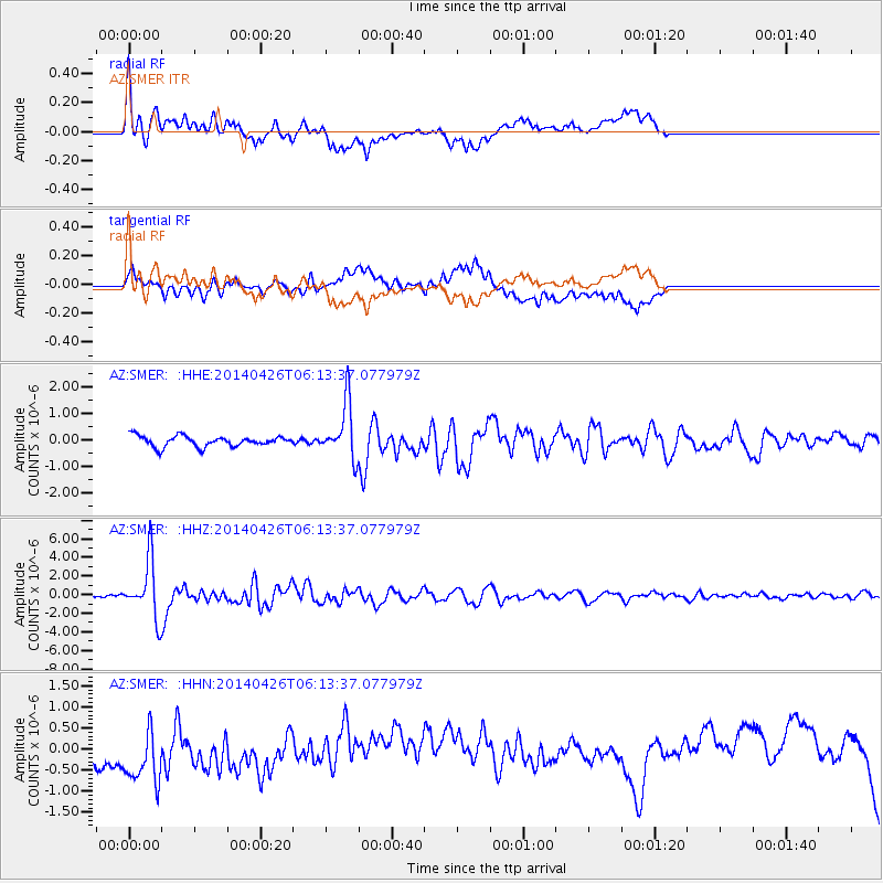
SMER AZ.SMER - Earthquake Result Viewer
*The percent match for this event was below the threshold and hence no stack was calculated.
| Earthquake location: |
Tonga Islands |
| Earthquake latitude/longitude: |
-20.7/-174.7 |
| Earthquake time(UTC): |
2014/04/26 (116) 06:02:16 GMT |
| Earthquake Depth: |
10 km |
| Earthquake Magnitude: |
6.5 MWP |
| Earthquake Catalog/Contributor: |
NEIC PDE/NEIC COMCAT |
|
| Network: |
AZ ANZA Regional Network |
| Station: |
SMER AZ.SMER |
| Lat/Lon: |
33.46 N/117.17 W |
| Elevation: |
355 m |
|
| Distance: |
76.9 deg |
| Az: |
46.391 deg |
| Baz: |
234.173 deg |
| Ray Param: |
$rayparam |
*The percent match for this event was below the threshold and hence was not used in the summary stack. |
|
| Radial Match: |
66.03456 % |
| Radial Bump: |
400 |
| Transverse Match: |
39.23483 % |
| Transverse Bump: |
400 |
| SOD ConfigId: |
626651 |
| Insert Time: |
2014-05-10 06:14:39.117 +0000 |
| GWidth: |
2.5 |
| Max Bumps: |
400 |
| Tol: |
0.001 |
|
Signal To Noise
| Channel | StoN | STA | LTA |
| AZ:SMER: :HHZ:20140426T06:13:37.077979Z | 14.308563 | 3.0317783E-6 | 2.1188558E-7 |
| AZ:SMER: :HHN:20140426T06:13:37.077979Z | 2.370031 | 8.61362E-7 | 3.634391E-7 |
| AZ:SMER: :HHE:20140426T06:13:37.077979Z | 5.1502814 | 1.027064E-6 | 1.99419E-7 |
| Arrivals |
| Ps | |
| PpPs | |
| PsPs/PpSs | |


