You are here: Home > Network List > US - United States National Seismic Network Stations List
> Station WMOK Wichita Mountains, Oklahoma, USA > Earthquake Result Viewer
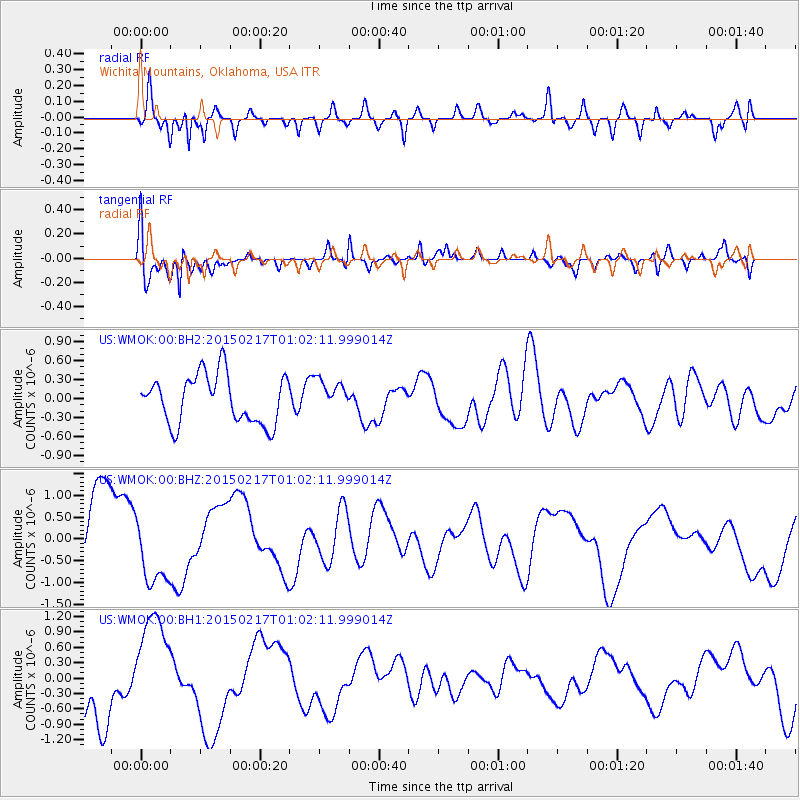
WMOK Wichita Mountains, Oklahoma, USA - Earthquake Result Viewer
*The percent match for this event was below the threshold and hence no stack was calculated.
| Earthquake location: |
Off East Coast Of Honshu, Japan |
| Earthquake latitude/longitude: |
39.9/143.3 |
| Earthquake time(UTC): |
2015/02/17 (048) 00:50:02 GMT |
| Earthquake Depth: |
10 km |
| Earthquake Magnitude: |
4.6 mb |
| Earthquake Catalog/Contributor: |
ISC/ISC |
|
| Network: |
US United States National Seismic Network |
| Station: |
WMOK Wichita Mountains, Oklahoma, USA |
| Lat/Lon: |
34.74 N/98.78 W |
| Elevation: |
486 m |
|
| Distance: |
86.2 deg |
| Az: |
46.853 deg |
| Baz: |
317.032 deg |
| Ray Param: |
$rayparam |
*The percent match for this event was below the threshold and hence was not used in the summary stack. |
|
| Radial Match: |
75.50535 % |
| Radial Bump: |
400 |
| Transverse Match: |
76.71805 % |
| Transverse Bump: |
400 |
| SOD ConfigId: |
7019011 |
| Insert Time: |
2019-04-16 21:01:26.222 +0000 |
| GWidth: |
2.5 |
| Max Bumps: |
400 |
| Tol: |
0.001 |
|
Signal To Noise
| Channel | StoN | STA | LTA |
| US:WMOK:00:BHZ:20150217T01:02:11.999014Z | 0.886061 | 8.388297E-7 | 9.4669514E-7 |
| US:WMOK:00:BH1:20150217T01:02:11.999014Z | 1.8386892 | 1.0597396E-6 | 5.7635594E-7 |
| US:WMOK:00:BH2:20150217T01:02:11.999014Z | 0.6372455 | 2.4608534E-7 | 3.8617037E-7 |
| Arrivals |
| Ps | |
| PpPs | |
| PsPs/PpSs | |


