You are here: Home > Network List > TA - USArray Transportable Network (new EarthScope stations) Stations List
> Station G03D McMinnville, OR, USA > Earthquake Result Viewer
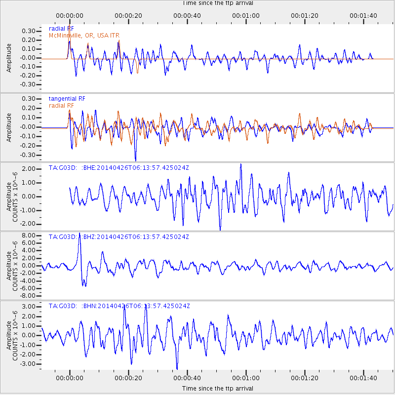
G03D McMinnville, OR, USA - Earthquake Result Viewer
*The percent match for this event was below the threshold and hence no stack was calculated.
| Earthquake location: |
Tonga Islands |
| Earthquake latitude/longitude: |
-20.7/-174.7 |
| Earthquake time(UTC): |
2014/04/26 (116) 06:02:16 GMT |
| Earthquake Depth: |
10 km |
| Earthquake Magnitude: |
6.5 MWP |
| Earthquake Catalog/Contributor: |
NEIC PDE/NEIC COMCAT |
|
| Network: |
TA USArray Transportable Network (new EarthScope stations) |
| Station: |
G03D McMinnville, OR, USA |
| Lat/Lon: |
45.21 N/123.26 W |
| Elevation: |
222 m |
|
| Distance: |
80.6 deg |
| Az: |
34.062 deg |
| Baz: |
227.879 deg |
| Ray Param: |
$rayparam |
*The percent match for this event was below the threshold and hence was not used in the summary stack. |
|
| Radial Match: |
71.753044 % |
| Radial Bump: |
400 |
| Transverse Match: |
77.61069 % |
| Transverse Bump: |
400 |
| SOD ConfigId: |
626651 |
| Insert Time: |
2014-05-10 06:33:59.277 +0000 |
| GWidth: |
2.5 |
| Max Bumps: |
400 |
| Tol: |
0.001 |
|
Signal To Noise
| Channel | StoN | STA | LTA |
| TA:G03D: :BHZ:20140426T06:13:57.425024Z | 6.5560994 | 3.3840572E-6 | 5.161693E-7 |
| TA:G03D: :BHN:20140426T06:13:57.425024Z | 1.4138811 | 7.3605855E-7 | 5.205944E-7 |
| TA:G03D: :BHE:20140426T06:13:57.425024Z | 1.3733064 | 6.46049E-7 | 4.7043326E-7 |
| Arrivals |
| Ps | |
| PpPs | |
| PsPs/PpSs | |


