You are here: Home > Network List > TA - USArray Transportable Network (new EarthScope stations) Stations List
> Station G05D Wamic, OR, USA > Earthquake Result Viewer
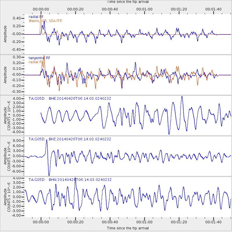
G05D Wamic, OR, USA - Earthquake Result Viewer
*The percent match for this event was below the threshold and hence no stack was calculated.
| Earthquake location: |
Tonga Islands |
| Earthquake latitude/longitude: |
-20.7/-174.7 |
| Earthquake time(UTC): |
2014/04/26 (116) 06:02:16 GMT |
| Earthquake Depth: |
10 km |
| Earthquake Magnitude: |
6.5 MWP |
| Earthquake Catalog/Contributor: |
NEIC PDE/NEIC COMCAT |
|
| Network: |
TA USArray Transportable Network (new EarthScope stations) |
| Station: |
G05D Wamic, OR, USA |
| Lat/Lon: |
45.24 N/121.32 W |
| Elevation: |
592 m |
|
| Distance: |
81.6 deg |
| Az: |
34.959 deg |
| Baz: |
229.396 deg |
| Ray Param: |
$rayparam |
*The percent match for this event was below the threshold and hence was not used in the summary stack. |
|
| Radial Match: |
79.297005 % |
| Radial Bump: |
343 |
| Transverse Match: |
77.3236 % |
| Transverse Bump: |
400 |
| SOD ConfigId: |
626651 |
| Insert Time: |
2014-05-10 06:34:02.685 +0000 |
| GWidth: |
2.5 |
| Max Bumps: |
400 |
| Tol: |
0.001 |
|
Signal To Noise
| Channel | StoN | STA | LTA |
| TA:G05D: :BHZ:20140426T06:14:03.024023Z | 13.964824 | 4.9096984E-6 | 3.5157612E-7 |
| TA:G05D: :BHN:20140426T06:14:03.024023Z | 1.5032194 | 9.917024E-7 | 6.5971903E-7 |
| TA:G05D: :BHE:20140426T06:14:03.024023Z | 1.1333549 | 1.1635033E-6 | 1.026601E-6 |
| Arrivals |
| Ps | |
| PpPs | |
| PsPs/PpSs | |


