You are here: Home > Network List > TA - USArray Transportable Network (new EarthScope stations) Stations List
> Station J05D Fort Rock, OR, USA > Earthquake Result Viewer
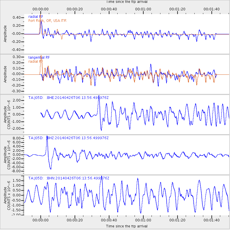
J05D Fort Rock, OR, USA - Earthquake Result Viewer
*The percent match for this event was below the threshold and hence no stack was calculated.
| Earthquake location: |
Tonga Islands |
| Earthquake latitude/longitude: |
-20.7/-174.7 |
| Earthquake time(UTC): |
2014/04/26 (116) 06:02:16 GMT |
| Earthquake Depth: |
10 km |
| Earthquake Magnitude: |
6.5 MWP |
| Earthquake Catalog/Contributor: |
NEIC PDE/NEIC COMCAT |
|
| Network: |
TA USArray Transportable Network (new EarthScope stations) |
| Station: |
J05D Fort Rock, OR, USA |
| Lat/Lon: |
43.28 N/121.23 W |
| Elevation: |
1541 m |
|
| Distance: |
80.4 deg |
| Az: |
36.505 deg |
| Baz: |
229.695 deg |
| Ray Param: |
$rayparam |
*The percent match for this event was below the threshold and hence was not used in the summary stack. |
|
| Radial Match: |
76.81933 % |
| Radial Bump: |
400 |
| Transverse Match: |
75.565506 % |
| Transverse Bump: |
400 |
| SOD ConfigId: |
626651 |
| Insert Time: |
2014-05-10 06:34:39.752 +0000 |
| GWidth: |
2.5 |
| Max Bumps: |
400 |
| Tol: |
0.001 |
|
Signal To Noise
| Channel | StoN | STA | LTA |
| TA:J05D: :BHZ:20140426T06:13:56.499976Z | 6.8186 | 3.0991414E-6 | 4.5451281E-7 |
| TA:J05D: :BHN:20140426T06:13:56.499976Z | 1.5580653 | 7.722082E-7 | 4.9561993E-7 |
| TA:J05D: :BHE:20140426T06:13:56.499976Z | 2.5358677 | 9.779602E-7 | 3.8565113E-7 |
| Arrivals |
| Ps | |
| PpPs | |
| PsPs/PpSs | |


