You are here: Home > Network List > WY - Yellowstone Wyoming Seismic Network Stations List
> Station YHH Holmes Hill, YNP, WY, USA > Earthquake Result Viewer
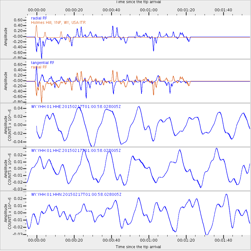
YHH Holmes Hill, YNP, WY, USA - Earthquake Result Viewer
*The percent match for this event was below the threshold and hence no stack was calculated.
| Earthquake location: |
Off East Coast Of Honshu, Japan |
| Earthquake latitude/longitude: |
39.9/143.3 |
| Earthquake time(UTC): |
2015/02/17 (048) 00:50:02 GMT |
| Earthquake Depth: |
10 km |
| Earthquake Magnitude: |
4.6 mb |
| Earthquake Catalog/Contributor: |
ISC/ISC |
|
| Network: |
WY Yellowstone Wyoming Seismic Network |
| Station: |
YHH Holmes Hill, YNP, WY, USA |
| Lat/Lon: |
44.79 N/110.85 W |
| Elevation: |
2717 m |
|
| Distance: |
72.6 deg |
| Az: |
45.896 deg |
| Baz: |
309.119 deg |
| Ray Param: |
$rayparam |
*The percent match for this event was below the threshold and hence was not used in the summary stack. |
|
| Radial Match: |
80.847145 % |
| Radial Bump: |
400 |
| Transverse Match: |
88.63594 % |
| Transverse Bump: |
400 |
| SOD ConfigId: |
7019011 |
| Insert Time: |
2019-04-16 21:01:49.496 +0000 |
| GWidth: |
2.5 |
| Max Bumps: |
400 |
| Tol: |
0.001 |
|
Signal To Noise
| Channel | StoN | STA | LTA |
| WY:YHH:01:HHZ:20150217T01:00:58.028005Z | 0.58612984 | 1.2895652E-8 | 2.2001355E-8 |
| WY:YHH:01:HHN:20150217T01:00:58.028005Z | 0.6641609 | 8.386746E-9 | 1.26275825E-8 |
| WY:YHH:01:HHE:20150217T01:00:58.028005Z | 1.5399626 | 3.656945E-8 | 2.374697E-8 |
| Arrivals |
| Ps | |
| PpPs | |
| PsPs/PpSs | |


