You are here: Home > Network List > TA - USArray Transportable Network (new EarthScope stations) Stations List
> Station L04D Klamath Falls, OR, USA > Earthquake Result Viewer
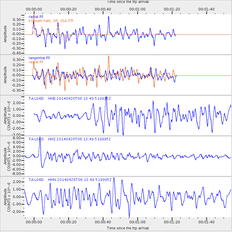
L04D Klamath Falls, OR, USA - Earthquake Result Viewer
*The percent match for this event was below the threshold and hence no stack was calculated.
| Earthquake location: |
Tonga Islands |
| Earthquake latitude/longitude: |
-20.7/-174.7 |
| Earthquake time(UTC): |
2014/04/26 (116) 06:02:16 GMT |
| Earthquake Depth: |
10 km |
| Earthquake Magnitude: |
6.5 MWP |
| Earthquake Catalog/Contributor: |
NEIC PDE/NEIC COMCAT |
|
| Network: |
TA USArray Transportable Network (new EarthScope stations) |
| Station: |
L04D Klamath Falls, OR, USA |
| Lat/Lon: |
42.22 N/122.30 W |
| Elevation: |
1437 m |
|
| Distance: |
79.1 deg |
| Az: |
36.806 deg |
| Baz: |
229.025 deg |
| Ray Param: |
$rayparam |
*The percent match for this event was below the threshold and hence was not used in the summary stack. |
|
| Radial Match: |
70.79199 % |
| Radial Bump: |
400 |
| Transverse Match: |
58.72667 % |
| Transverse Bump: |
400 |
| SOD ConfigId: |
626651 |
| Insert Time: |
2014-05-10 06:34:59.884 +0000 |
| GWidth: |
2.5 |
| Max Bumps: |
400 |
| Tol: |
0.001 |
|
Signal To Noise
| Channel | StoN | STA | LTA |
| TA:L04D: :HHZ:20140426T06:13:49.519995Z | 7.7636647 | 3.1534494E-6 | 4.0618053E-7 |
| TA:L04D: :HHN:20140426T06:13:49.519995Z | 0.62454367 | 4.1667786E-7 | 6.6717166E-7 |
| TA:L04D: :HHE:20140426T06:13:49.519995Z | 2.3142338 | 8.244567E-7 | 3.5625473E-7 |
| Arrivals |
| Ps | |
| PpPs | |
| PsPs/PpSs | |


