You are here: Home > Network List > US - United States National Seismic Network Stations List
> Station DGMT Dagmar, Montana, USA > Earthquake Result Viewer
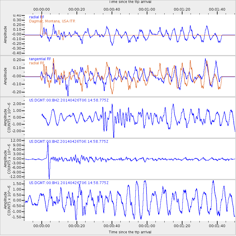
DGMT Dagmar, Montana, USA - Earthquake Result Viewer
*The percent match for this event was below the threshold and hence no stack was calculated.
| Earthquake location: |
Tonga Islands |
| Earthquake latitude/longitude: |
-20.7/-174.7 |
| Earthquake time(UTC): |
2014/04/26 (116) 06:02:16 GMT |
| Earthquake Depth: |
10 km |
| Earthquake Magnitude: |
6.5 MWP |
| Earthquake Catalog/Contributor: |
NEIC PDE/NEIC COMCAT |
|
| Network: |
US United States National Seismic Network |
| Station: |
DGMT Dagmar, Montana, USA |
| Lat/Lon: |
48.47 N/104.20 W |
| Elevation: |
0.0 m |
|
| Distance: |
93.1 deg |
| Az: |
38.916 deg |
| Baz: |
242.081 deg |
| Ray Param: |
$rayparam |
*The percent match for this event was below the threshold and hence was not used in the summary stack. |
|
| Radial Match: |
69.86602 % |
| Radial Bump: |
400 |
| Transverse Match: |
64.28325 % |
| Transverse Bump: |
400 |
| SOD ConfigId: |
626651 |
| Insert Time: |
2014-05-10 06:37:18.169 +0000 |
| GWidth: |
2.5 |
| Max Bumps: |
400 |
| Tol: |
0.001 |
|
Signal To Noise
| Channel | StoN | STA | LTA |
| US:DGMT:00:BHZ:20140426T06:14:58.775Z | 18.476683 | 4.858936E-6 | 2.629766E-7 |
| US:DGMT:00:BH1:20140426T06:14:58.775Z | 1.0819627 | 5.942628E-7 | 5.4924516E-7 |
| US:DGMT:00:BH2:20140426T06:14:58.775Z | 0.9713027 | 5.4425175E-7 | 5.603318E-7 |
| Arrivals |
| Ps | |
| PpPs | |
| PsPs/PpSs | |


