You are here: Home > Network List > US - United States National Seismic Network Stations List
> Station MIAR Mount Ida, Arkansas, USA > Earthquake Result Viewer
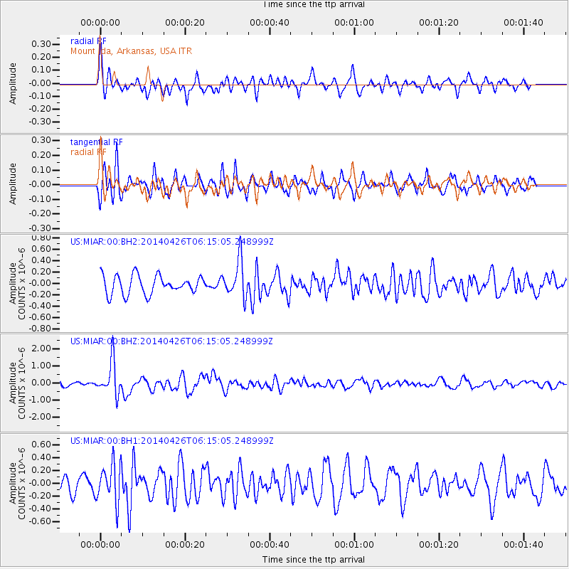
MIAR Mount Ida, Arkansas, USA - Earthquake Result Viewer
*The percent match for this event was below the threshold and hence no stack was calculated.
| Earthquake location: |
Tonga Islands |
| Earthquake latitude/longitude: |
-20.7/-174.7 |
| Earthquake time(UTC): |
2014/04/26 (116) 06:02:16 GMT |
| Earthquake Depth: |
10 km |
| Earthquake Magnitude: |
6.5 MWP |
| Earthquake Catalog/Contributor: |
NEIC PDE/NEIC COMCAT |
|
| Network: |
US United States National Seismic Network |
| Station: |
MIAR Mount Ida, Arkansas, USA |
| Lat/Lon: |
34.55 N/93.58 W |
| Elevation: |
207 m |
|
| Distance: |
94.5 deg |
| Az: |
54.891 deg |
| Baz: |
248.084 deg |
| Ray Param: |
$rayparam |
*The percent match for this event was below the threshold and hence was not used in the summary stack. |
|
| Radial Match: |
72.26017 % |
| Radial Bump: |
400 |
| Transverse Match: |
54.203133 % |
| Transverse Bump: |
358 |
| SOD ConfigId: |
626651 |
| Insert Time: |
2014-05-10 06:38:10.243 +0000 |
| GWidth: |
2.5 |
| Max Bumps: |
400 |
| Tol: |
0.001 |
|
Signal To Noise
| Channel | StoN | STA | LTA |
| US:MIAR:00:BHZ:20140426T06:15:05.248999Z | 6.383584 | 1.0003174E-6 | 1.5670153E-7 |
| US:MIAR:00:BH1:20140426T06:15:05.248999Z | 1.766284 | 2.997406E-7 | 1.6970125E-7 |
| US:MIAR:00:BH2:20140426T06:15:05.248999Z | 2.063267 | 3.3474123E-7 | 1.6223845E-7 |
| Arrivals |
| Ps | |
| PpPs | |
| PsPs/PpSs | |


