You are here: Home > Network List > UW - Pacific Northwest Regional Seismic Network Stations List
> Station LEBA Lebam, WA, USA > Earthquake Result Viewer
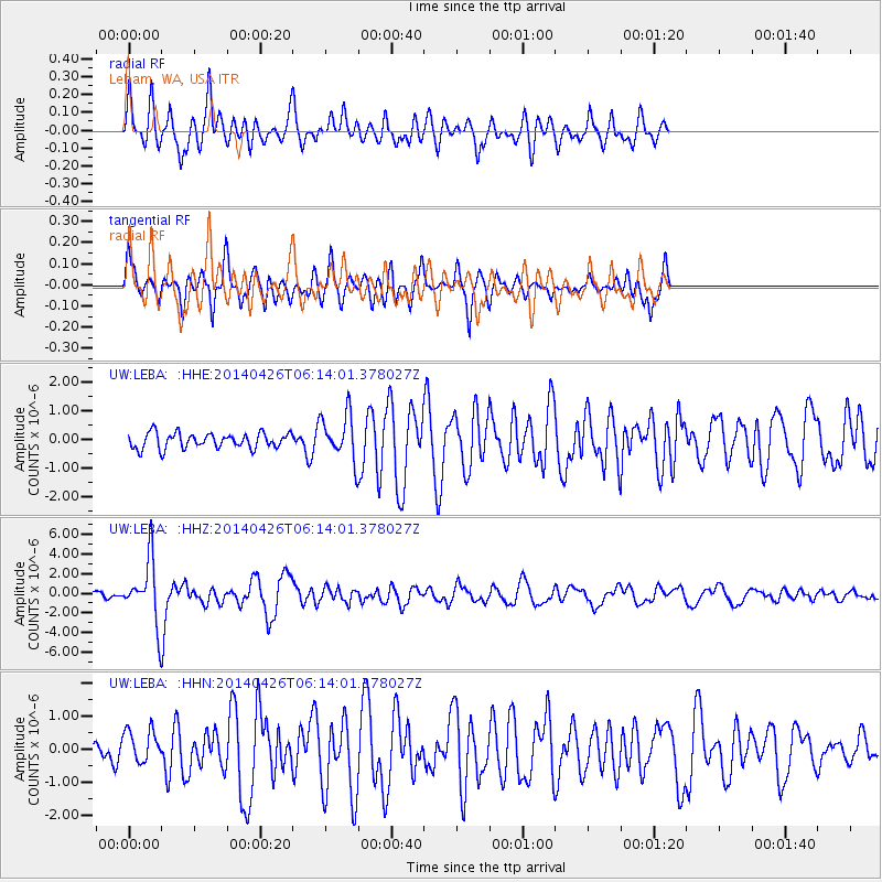
LEBA Lebam, WA, USA - Earthquake Result Viewer
*The percent match for this event was below the threshold and hence no stack was calculated.
| Earthquake location: |
Tonga Islands |
| Earthquake latitude/longitude: |
-20.7/-174.7 |
| Earthquake time(UTC): |
2014/04/26 (116) 06:02:16 GMT |
| Earthquake Depth: |
10 km |
| Earthquake Magnitude: |
6.5 MWP |
| Earthquake Catalog/Contributor: |
NEIC PDE/NEIC COMCAT |
|
| Network: |
UW Pacific Northwest Regional Seismic Network |
| Station: |
LEBA Lebam, WA, USA |
| Lat/Lon: |
46.55 N/123.56 W |
| Elevation: |
73 m |
|
| Distance: |
81.3 deg |
| Az: |
32.92 deg |
| Baz: |
227.485 deg |
| Ray Param: |
$rayparam |
*The percent match for this event was below the threshold and hence was not used in the summary stack. |
|
| Radial Match: |
67.61369 % |
| Radial Bump: |
400 |
| Transverse Match: |
70.17194 % |
| Transverse Bump: |
400 |
| SOD ConfigId: |
626651 |
| Insert Time: |
2014-05-10 06:42:10.322 +0000 |
| GWidth: |
2.5 |
| Max Bumps: |
400 |
| Tol: |
0.001 |
|
Signal To Noise
| Channel | StoN | STA | LTA |
| UW:LEBA: :HHZ:20140426T06:14:01.378027Z | 8.006516 | 3.0905371E-6 | 3.860027E-7 |
| UW:LEBA: :HHN:20140426T06:14:01.378027Z | 1.4350874 | 5.011459E-7 | 3.4920933E-7 |
| UW:LEBA: :HHE:20140426T06:14:01.378027Z | 2.952045 | 7.9110254E-7 | 2.6798457E-7 |
| Arrivals |
| Ps | |
| PpPs | |
| PsPs/PpSs | |


