You are here: Home > Network List > UW - Pacific Northwest Regional Seismic Network Stations List
> Station MRBL Marblemount, WA, USA > Earthquake Result Viewer
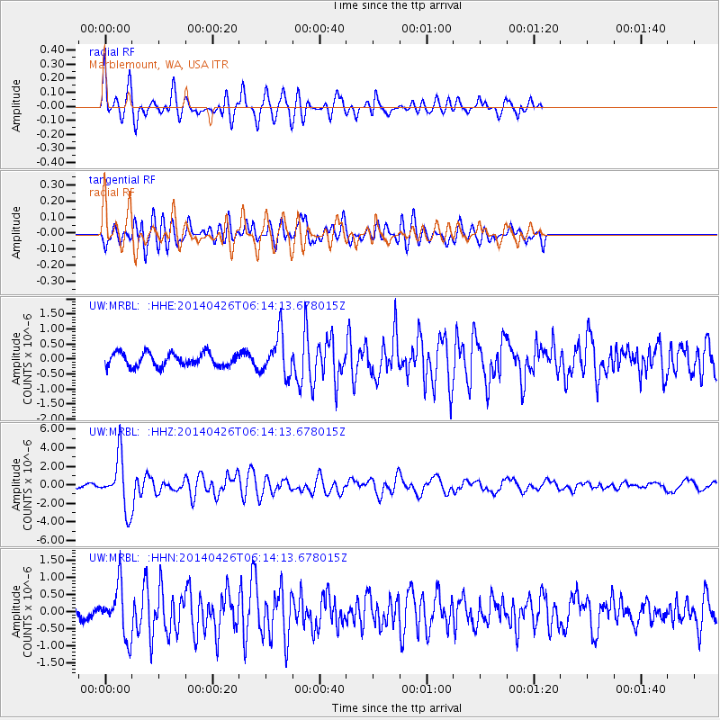
MRBL Marblemount, WA, USA - Earthquake Result Viewer
*The percent match for this event was below the threshold and hence no stack was calculated.
| Earthquake location: |
Tonga Islands |
| Earthquake latitude/longitude: |
-20.7/-174.7 |
| Earthquake time(UTC): |
2014/04/26 (116) 06:02:16 GMT |
| Earthquake Depth: |
10 km |
| Earthquake Magnitude: |
6.5 MWP |
| Earthquake Catalog/Contributor: |
NEIC PDE/NEIC COMCAT |
|
| Network: |
UW Pacific Northwest Regional Seismic Network |
| Station: |
MRBL Marblemount, WA, USA |
| Lat/Lon: |
48.52 N/121.48 W |
| Elevation: |
75 m |
|
| Distance: |
83.7 deg |
| Az: |
32.383 deg |
| Baz: |
228.944 deg |
| Ray Param: |
$rayparam |
*The percent match for this event was below the threshold and hence was not used in the summary stack. |
|
| Radial Match: |
73.424385 % |
| Radial Bump: |
400 |
| Transverse Match: |
70.68268 % |
| Transverse Bump: |
400 |
| SOD ConfigId: |
626651 |
| Insert Time: |
2014-05-10 06:42:25.311 +0000 |
| GWidth: |
2.5 |
| Max Bumps: |
400 |
| Tol: |
0.001 |
|
Signal To Noise
| Channel | StoN | STA | LTA |
| UW:MRBL: :HHZ:20140426T06:14:13.678015Z | 13.354206 | 2.8242216E-6 | 2.1148556E-7 |
| UW:MRBL: :HHN:20140426T06:14:13.678015Z | 4.3408237 | 7.368147E-7 | 1.6974076E-7 |
| UW:MRBL: :HHE:20140426T06:14:13.678015Z | 3.0800402 | 6.765447E-7 | 2.1965448E-7 |
| Arrivals |
| Ps | |
| PpPs | |
| PsPs/PpSs | |


