You are here: Home > Network List > II - Global Seismograph Network (GSN - IRIS/IDA) Stations List
> Station WRAB Tennant Creek, NT, Australia > Earthquake Result Viewer
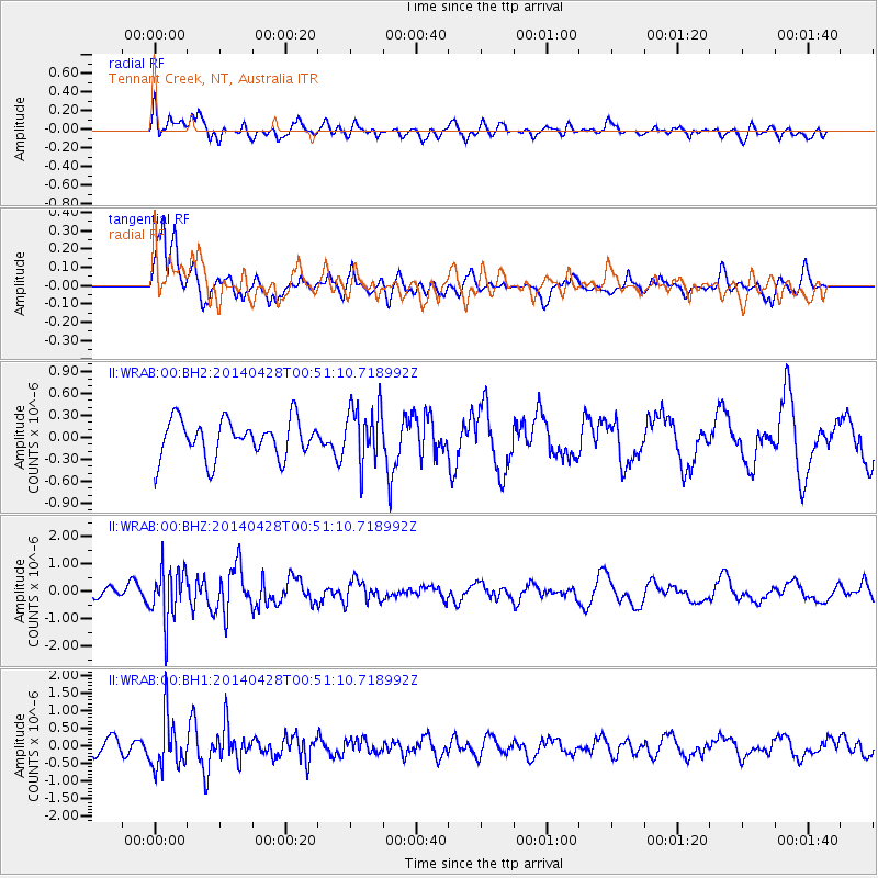
WRAB Tennant Creek, NT, Australia - Earthquake Result Viewer
*The percent match for this event was below the threshold and hence no stack was calculated.
| Earthquake location: |
Philippine Islands Region |
| Earthquake latitude/longitude: |
19.7/120.0 |
| Earthquake time(UTC): |
2014/04/28 (118) 00:43:51 GMT |
| Earthquake Depth: |
10 km |
| Earthquake Magnitude: |
5.6 MWP |
| Earthquake Catalog/Contributor: |
NEIC PDE/NEIC COMCAT |
|
| Network: |
II Global Seismograph Network (GSN - IRIS/IDA) |
| Station: |
WRAB Tennant Creek, NT, Australia |
| Lat/Lon: |
19.93 S/134.36 E |
| Elevation: |
366 m |
|
| Distance: |
41.8 deg |
| Az: |
159.575 deg |
| Baz: |
339.546 deg |
| Ray Param: |
$rayparam |
*The percent match for this event was below the threshold and hence was not used in the summary stack. |
|
| Radial Match: |
48.8071 % |
| Radial Bump: |
400 |
| Transverse Match: |
73.344406 % |
| Transverse Bump: |
400 |
| SOD ConfigId: |
626651 |
| Insert Time: |
2014-05-12 01:12:24.657 +0000 |
| GWidth: |
2.5 |
| Max Bumps: |
400 |
| Tol: |
0.001 |
|
Signal To Noise
| Channel | StoN | STA | LTA |
| II:WRAB:00:BHZ:20140428T00:51:10.718992Z | 4.0474577 | 9.647038E-7 | 2.3834806E-7 |
| II:WRAB:00:BH1:20140428T00:51:10.718992Z | 4.4480243 | 7.3711203E-7 | 1.6571673E-7 |
| II:WRAB:00:BH2:20140428T00:51:10.718992Z | 1.5179983 | 3.9379603E-7 | 2.5941796E-7 |
| Arrivals |
| Ps | |
| PpPs | |
| PsPs/PpSs | |


