You are here: Home > Network List > KN - Kyrgyz Seismic Telemetry Network Stations List
> Station TKM2 - > Earthquake Result Viewer
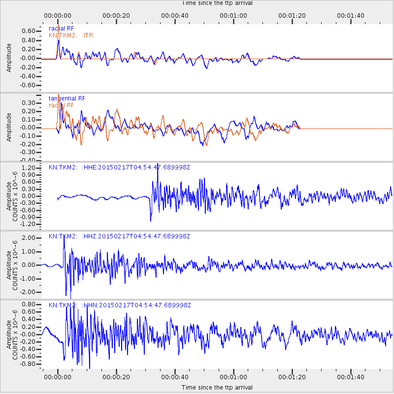
TKM2 - - Earthquake Result Viewer
*The percent match for this event was below the threshold and hence no stack was calculated.
| Earthquake location: |
Near East Coast Of Honshu, Japan |
| Earthquake latitude/longitude: |
40.2/141.9 |
| Earthquake time(UTC): |
2015/02/17 (048) 04:46:38 GMT |
| Earthquake Depth: |
40 km |
| Earthquake Magnitude: |
5.8 MB |
| Earthquake Catalog/Contributor: |
NEIC PDE/NEIC COMCAT |
|
| Network: |
KN Kyrgyz Seismic Telemetry Network |
| Station: |
TKM2 - |
| Lat/Lon: |
42.92 N/75.60 E |
| Elevation: |
2020 m |
|
| Distance: |
48.5 deg |
| Az: |
296.14 deg |
| Baz: |
69.445 deg |
| Ray Param: |
$rayparam |
*The percent match for this event was below the threshold and hence was not used in the summary stack. |
|
| Radial Match: |
66.29796 % |
| Radial Bump: |
400 |
| Transverse Match: |
69.30762 % |
| Transverse Bump: |
400 |
| SOD ConfigId: |
7019011 |
| Insert Time: |
2019-04-16 21:16:15.821 +0000 |
| GWidth: |
2.5 |
| Max Bumps: |
400 |
| Tol: |
0.001 |
|
Signal To Noise
| Channel | StoN | STA | LTA |
| KN:TKM2: :HHZ:20150217T04:54:47.689998Z | 7.022674 | 8.994763E-7 | 1.2808174E-7 |
| KN:TKM2: :HHN:20150217T04:54:47.689998Z | 1.9311669 | 3.2905746E-7 | 1.7039308E-7 |
| KN:TKM2: :HHE:20150217T04:54:47.689998Z | 6.8630466 | 4.08812E-7 | 5.9567135E-8 |
| Arrivals |
| Ps | |
| PpPs | |
| PsPs/PpSs | |


