You are here: Home > Network List > AK - Alaska Regional Network Stations List
> Station MDM Murphy Dome > Earthquake Result Viewer
MDM Murphy Dome - Earthquake Result Viewer
*The percent match for this event was below the threshold and hence no stack was calculated.
| Earthquake location: |
Southeast Of Loyalty Islands |
| Earthquake latitude/longitude: |
-21.5/170.2 |
| Earthquake time(UTC): |
2014/05/01 (121) 06:36:37 GMT |
| Earthquake Depth: |
118 km |
| Earthquake Magnitude: |
6.7 MWP, 6.7 MI |
| Earthquake Catalog/Contributor: |
NEIC PDE/NEIC COMCAT |
|
| Network: |
AK Alaska Regional Network |
| Station: |
MDM Murphy Dome |
| Lat/Lon: |
64.96 N/148.23 W |
| Elevation: |
634 m |
|
| Distance: |
91.9 deg |
| Az: |
16.408 deg |
| Baz: |
218.173 deg |
| Ray Param: |
$rayparam |
*The percent match for this event was below the threshold and hence was not used in the summary stack. |
|
| Radial Match: |
67.4727 % |
| Radial Bump: |
400 |
| Transverse Match: |
67.536865 % |
| Transverse Bump: |
400 |
| SOD ConfigId: |
626651 |
| Insert Time: |
2014-05-15 06:54:08.449 +0000 |
| GWidth: |
2.5 |
| Max Bumps: |
400 |
| Tol: |
0.001 |
|
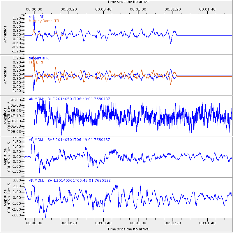
Signal To Noise
| Channel | StoN | STA | LTA |
| AK:MDM: :BHZ:20140501T06:49:01.768013Z | 6.6099706 | 9.295419E-7 | 1.4062724E-7 |
| AK:MDM: :BHN:20140501T06:49:01.768013Z | 2.3777559 | 1.4934436E-6 | 6.2808954E-7 |
| AK:MDM: :BHE:20140501T06:49:01.768013Z | 0.6813797 | 2.6630467E-9 | 3.9083154E-9 |
| Arrivals |
| Ps | |
| PpPs | |
| PsPs/PpSs | |


