You are here: Home > Network List > UW - Pacific Northwest Regional Seismic Network Stations List
> Station LEBA Lebam, WA, USA > Earthquake Result Viewer
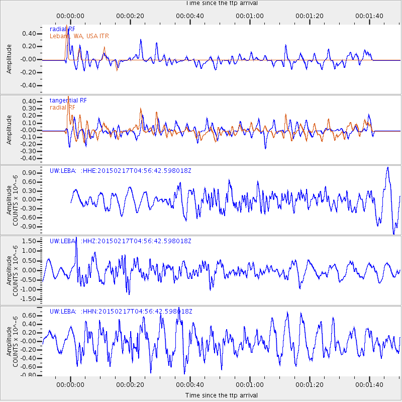
LEBA Lebam, WA, USA - Earthquake Result Viewer
*The percent match for this event was below the threshold and hence no stack was calculated.
| Earthquake location: |
Near East Coast Of Honshu, Japan |
| Earthquake latitude/longitude: |
40.2/141.9 |
| Earthquake time(UTC): |
2015/02/17 (048) 04:46:38 GMT |
| Earthquake Depth: |
40 km |
| Earthquake Magnitude: |
5.8 MB |
| Earthquake Catalog/Contributor: |
NEIC PDE/NEIC COMCAT |
|
| Network: |
UW Pacific Northwest Regional Seismic Network |
| Station: |
LEBA Lebam, WA, USA |
| Lat/Lon: |
46.55 N/123.56 W |
| Elevation: |
73 m |
|
| Distance: |
65.0 deg |
| Az: |
49.407 deg |
| Baz: |
302.549 deg |
| Ray Param: |
$rayparam |
*The percent match for this event was below the threshold and hence was not used in the summary stack. |
|
| Radial Match: |
62.62204 % |
| Radial Bump: |
400 |
| Transverse Match: |
63.197857 % |
| Transverse Bump: |
400 |
| SOD ConfigId: |
7019011 |
| Insert Time: |
2019-04-16 21:21:30.628 +0000 |
| GWidth: |
2.5 |
| Max Bumps: |
400 |
| Tol: |
0.001 |
|
Signal To Noise
| Channel | StoN | STA | LTA |
| UW:LEBA: :HHZ:20150217T04:56:42.598018Z | 2.092421 | 5.921697E-7 | 2.8300695E-7 |
| UW:LEBA: :HHN:20150217T04:56:42.598018Z | 0.9185732 | 2.8471948E-7 | 3.0995838E-7 |
| UW:LEBA: :HHE:20150217T04:56:42.598018Z | 0.74264294 | 1.7533971E-7 | 2.361023E-7 |
| Arrivals |
| Ps | |
| PpPs | |
| PsPs/PpSs | |


