You are here: Home > Network List > IW - Intermountain West Stations List
> Station IMW Indian Meadow, Wyoming, USA > Earthquake Result Viewer
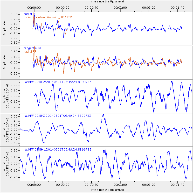
IMW Indian Meadow, Wyoming, USA - Earthquake Result Viewer
*The percent match for this event was below the threshold and hence no stack was calculated.
| Earthquake location: |
Southeast Of Loyalty Islands |
| Earthquake latitude/longitude: |
-21.5/170.2 |
| Earthquake time(UTC): |
2014/05/01 (121) 06:36:37 GMT |
| Earthquake Depth: |
118 km |
| Earthquake Magnitude: |
6.7 MWP, 6.7 MI |
| Earthquake Catalog/Contributor: |
NEIC PDE/NEIC COMCAT |
|
| Network: |
IW Intermountain West |
| Station: |
IMW Indian Meadow, Wyoming, USA |
| Lat/Lon: |
43.90 N/110.94 W |
| Elevation: |
2646 m |
|
| Distance: |
97.0 deg |
| Az: |
45.607 deg |
| Baz: |
246.989 deg |
| Ray Param: |
$rayparam |
*The percent match for this event was below the threshold and hence was not used in the summary stack. |
|
| Radial Match: |
67.95096 % |
| Radial Bump: |
400 |
| Transverse Match: |
49.034462 % |
| Transverse Bump: |
400 |
| SOD ConfigId: |
626651 |
| Insert Time: |
2014-05-15 07:11:44.186 +0000 |
| GWidth: |
2.5 |
| Max Bumps: |
400 |
| Tol: |
0.001 |
|
Signal To Noise
| Channel | StoN | STA | LTA |
| IW:IMW:00:BHZ:20140501T06:49:24.839973Z | 2.6466525 | 2.3618072E-7 | 8.923753E-8 |
| IW:IMW:00:BH1:20140501T06:49:24.839973Z | 2.295163 | 1.4434555E-7 | 6.28912E-8 |
| IW:IMW:00:BH2:20140501T06:49:24.839973Z | 0.86287546 | 9.0657224E-8 | 1.0506409E-7 |
| Arrivals |
| Ps | |
| PpPs | |
| PsPs/PpSs | |


