You are here: Home > Network List > TA - USArray Transportable Network (new EarthScope stations) Stations List
> Station J01E Myrtle Point, OR, USA > Earthquake Result Viewer
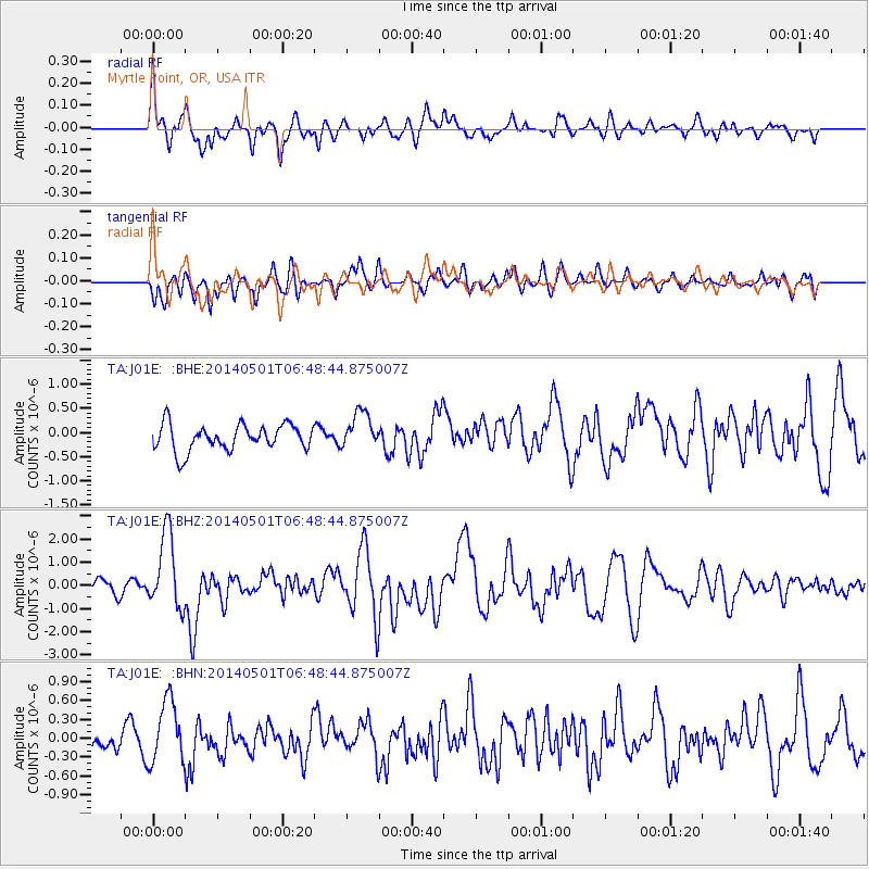
J01E Myrtle Point, OR, USA - Earthquake Result Viewer
*The percent match for this event was below the threshold and hence no stack was calculated.
| Earthquake location: |
Southeast Of Loyalty Islands |
| Earthquake latitude/longitude: |
-21.5/170.2 |
| Earthquake time(UTC): |
2014/05/01 (121) 06:36:37 GMT |
| Earthquake Depth: |
118 km |
| Earthquake Magnitude: |
6.7 MWP, 6.7 MI |
| Earthquake Catalog/Contributor: |
NEIC PDE/NEIC COMCAT |
|
| Network: |
TA USArray Transportable Network (new EarthScope stations) |
| Station: |
J01E Myrtle Point, OR, USA |
| Lat/Lon: |
43.16 N/123.93 W |
| Elevation: |
128 m |
|
| Distance: |
88.3 deg |
| Az: |
41.912 deg |
| Baz: |
238.222 deg |
| Ray Param: |
$rayparam |
*The percent match for this event was below the threshold and hence was not used in the summary stack. |
|
| Radial Match: |
72.40249 % |
| Radial Bump: |
400 |
| Transverse Match: |
57.16436 % |
| Transverse Bump: |
400 |
| SOD ConfigId: |
626651 |
| Insert Time: |
2014-05-15 07:17:38.632 +0000 |
| GWidth: |
2.5 |
| Max Bumps: |
400 |
| Tol: |
0.001 |
|
Signal To Noise
| Channel | StoN | STA | LTA |
| TA:J01E: :BHZ:20140501T06:48:44.875007Z | 6.7315903 | 1.633004E-6 | 2.4258816E-7 |
| TA:J01E: :BHN:20140501T06:48:44.875007Z | 3.050783 | 4.962798E-7 | 1.6267295E-7 |
| TA:J01E: :BHE:20140501T06:48:44.875007Z | 1.447888 | 3.8789355E-7 | 2.67903E-7 |
| Arrivals |
| Ps | |
| PpPs | |
| PsPs/PpSs | |


