You are here: Home > Network List > CI - Caltech Regional Seismic Network Stations List
> Station MPP McPhearson Peak > Earthquake Result Viewer
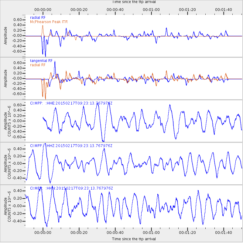
MPP McPhearson Peak - Earthquake Result Viewer
*The percent match for this event was below the threshold and hence no stack was calculated.
| Earthquake location: |
Kermadec Islands Region |
| Earthquake latitude/longitude: |
-27.0/-178.5 |
| Earthquake time(UTC): |
2015/02/17 (048) 09:11:58 GMT |
| Earthquake Depth: |
350 km |
| Earthquake Magnitude: |
4.6 mb |
| Earthquake Catalog/Contributor: |
ISC/ISC |
|
| Network: |
CI Caltech Regional Seismic Network |
| Station: |
MPP McPhearson Peak |
| Lat/Lon: |
34.89 N/119.81 W |
| Elevation: |
1739 m |
|
| Distance: |
82.9 deg |
| Az: |
45.051 deg |
| Baz: |
230.176 deg |
| Ray Param: |
$rayparam |
*The percent match for this event was below the threshold and hence was not used in the summary stack. |
|
| Radial Match: |
53.98886 % |
| Radial Bump: |
400 |
| Transverse Match: |
71.25489 % |
| Transverse Bump: |
400 |
| SOD ConfigId: |
7019011 |
| Insert Time: |
2019-04-16 21:30:09.903 +0000 |
| GWidth: |
2.5 |
| Max Bumps: |
400 |
| Tol: |
0.001 |
|
Signal To Noise
| Channel | StoN | STA | LTA |
| CI:MPP: :HHZ:20150217T09:23:13.767976Z | 1.453025 | 3.9489802E-7 | 2.7177646E-7 |
| CI:MPP: :HHN:20150217T09:23:13.767976Z | 1.3191077 | 3.3068937E-7 | 2.5069173E-7 |
| CI:MPP: :HHE:20150217T09:23:13.767976Z | 2.1687374 | 5.282751E-7 | 2.435865E-7 |
| Arrivals |
| Ps | |
| PpPs | |
| PsPs/PpSs | |


