You are here: Home > Network List > TA - USArray Transportable Network (new EarthScope stations) Stations List
> Station 121A Cookes Peak, Deming, NM, USA > Earthquake Result Viewer
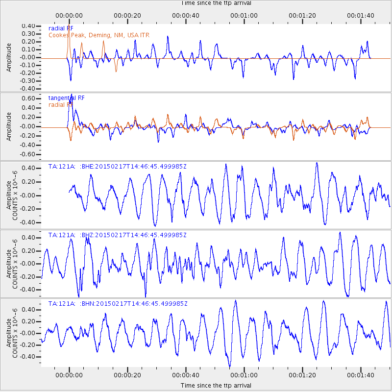
121A Cookes Peak, Deming, NM, USA - Earthquake Result Viewer
*The percent match for this event was below the threshold and hence no stack was calculated.
| Earthquake location: |
Chile-Argentina Border Region |
| Earthquake latitude/longitude: |
-32.3/-70.9 |
| Earthquake time(UTC): |
2015/02/17 (048) 14:35:53 GMT |
| Earthquake Depth: |
81 km |
| Earthquake Magnitude: |
5.4 MW |
| Earthquake Catalog/Contributor: |
ISC/ISC |
|
| Network: |
TA USArray Transportable Network (new EarthScope stations) |
| Station: |
121A Cookes Peak, Deming, NM, USA |
| Lat/Lon: |
32.53 N/107.79 W |
| Elevation: |
1652 m |
|
| Distance: |
73.3 deg |
| Az: |
328.074 deg |
| Baz: |
147.997 deg |
| Ray Param: |
$rayparam |
*The percent match for this event was below the threshold and hence was not used in the summary stack. |
|
| Radial Match: |
47.185913 % |
| Radial Bump: |
400 |
| Transverse Match: |
63.174362 % |
| Transverse Bump: |
400 |
| SOD ConfigId: |
7019011 |
| Insert Time: |
2019-04-16 21:39:07.511 +0000 |
| GWidth: |
2.5 |
| Max Bumps: |
400 |
| Tol: |
0.001 |
|
Signal To Noise
| Channel | StoN | STA | LTA |
| TA:121A: :BHZ:20150217T14:46:45.499985Z | 2.3706622 | 2.8327761E-7 | 1.1949304E-7 |
| TA:121A: :BHN:20150217T14:46:45.499985Z | 0.2990836 | 7.5932405E-8 | 2.5388357E-7 |
| TA:121A: :BHE:20150217T14:46:45.499985Z | 1.6995857 | 2.4888553E-7 | 1.4643895E-7 |
| Arrivals |
| Ps | |
| PpPs | |
| PsPs/PpSs | |


