You are here: Home > Network List > TA - USArray Transportable Network (new EarthScope stations) Stations List
> Station G59A Clarenceville, QC, USA > Earthquake Result Viewer
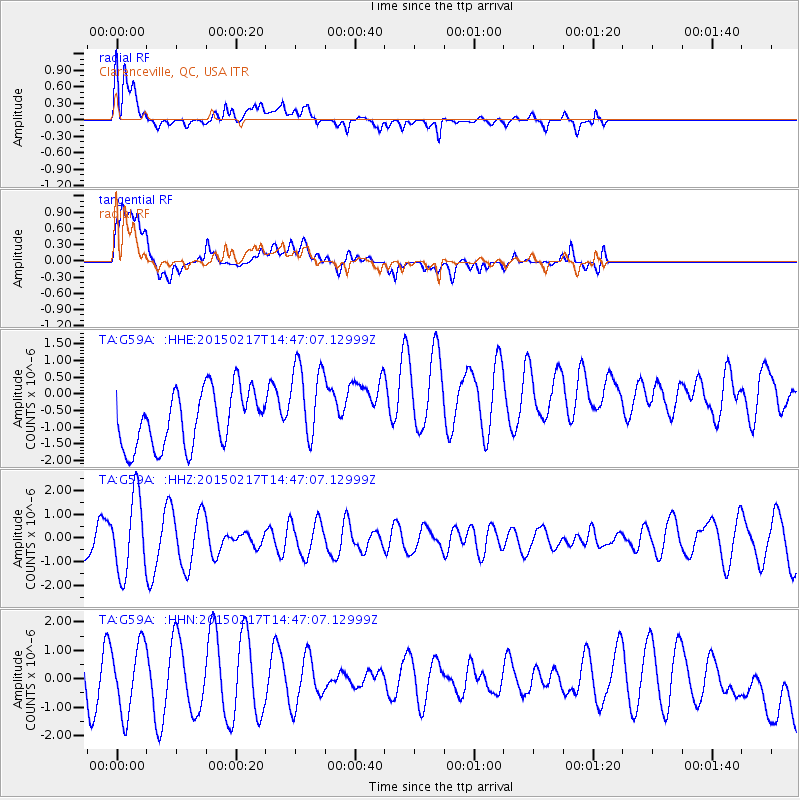
G59A Clarenceville, QC, USA - Earthquake Result Viewer
*The percent match for this event was below the threshold and hence no stack was calculated.
| Earthquake location: |
Chile-Argentina Border Region |
| Earthquake latitude/longitude: |
-32.3/-70.9 |
| Earthquake time(UTC): |
2015/02/17 (048) 14:35:53 GMT |
| Earthquake Depth: |
81 km |
| Earthquake Magnitude: |
5.4 MW |
| Earthquake Catalog/Contributor: |
ISC/ISC |
|
| Network: |
TA USArray Transportable Network (new EarthScope stations) |
| Station: |
G59A Clarenceville, QC, USA |
| Lat/Lon: |
45.08 N/73.18 W |
| Elevation: |
36 m |
|
| Distance: |
77.1 deg |
| Az: |
358.373 deg |
| Baz: |
178.056 deg |
| Ray Param: |
$rayparam |
*The percent match for this event was below the threshold and hence was not used in the summary stack. |
|
| Radial Match: |
67.921745 % |
| Radial Bump: |
400 |
| Transverse Match: |
47.642216 % |
| Transverse Bump: |
400 |
| SOD ConfigId: |
7019011 |
| Insert Time: |
2019-04-16 21:39:15.994 +0000 |
| GWidth: |
2.5 |
| Max Bumps: |
400 |
| Tol: |
0.001 |
|
Signal To Noise
| Channel | StoN | STA | LTA |
| TA:G59A: :HHZ:20150217T14:47:07.12999Z | 3.6791825 | 1.6215507E-6 | 4.4073667E-7 |
| TA:G59A: :HHN:20150217T14:47:07.12999Z | 1.19799 | 1.3403736E-6 | 1.1188522E-6 |
| TA:G59A: :HHE:20150217T14:47:07.12999Z | 1.5253587 | 1.281056E-6 | 8.3983923E-7 |
| Arrivals |
| Ps | |
| PpPs | |
| PsPs/PpSs | |


