PFO Pinon Flat, California, USA - Earthquake Result Viewer
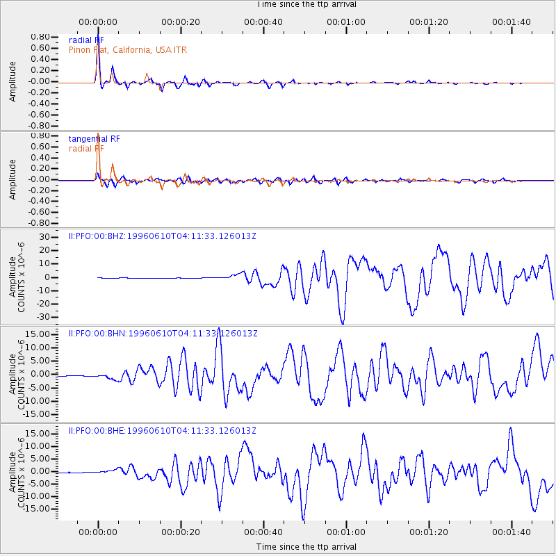
Earthquake location: Andreanof Islands, Aleutian Is.
Earthquake latitude/longitude: 51.6/-177.6
Earthquake time(UTC): 1996/06/10 (162) 04:03:35 GMT
Earthquake Depth: 33 km
Earthquake Magnitude: 6.6 MB, 7.6 MS, 7.9 UNKNOWN, 7.4 MS
Earthquake Catalog/Contributor: WHDF/NEIC
Network: II Global Seismograph Network (GSN - IRIS/IDA)
Station: PFO Pinon Flat, California, USA
Lat/Lon: 33.61 N/116.46 W
Elevation: 1280 m
Distance: 47.0 deg
Az: 87.684 deg
Baz: 311.639 deg
Ray Param: 0.07019241
Estimated Moho Depth: 29.5 km
Estimated Crust Vp/Vs: 1.71
Assumed Crust Vp: 6.264 km/s
Estimated Crust Vs: 3.658 km/s
Estimated Crust Poisson's Ratio: 0.24
Radial Match: 97.70717 %
Radial Bump: 231
Transverse Match: 88.18842 %
Transverse Bump: 400
SOD ConfigId: 6273
Insert Time: 2010-03-01 21:38:36.518 +0000
GWidth: 2.5
Max Bumps: 400
Tol: 0.001

Signal To Noise

ChannelStoNSTALTA
II:PFO:00:BHN:19960610T04:11:33.126013Z7.9415451.003389E-61.2634683E-7
II:PFO:00:BHE:19960610T04:11:33.126013Z9.1961668.2021717E-78.919121E-8
II:PFO:00:BHZ:19960610T04:11:33.126013Z14.4217742.0923285E-61.4508122E-7
Arrivals
Ps3.6 SECOND
PpPs12 SECOND
PsPs/PpSs16 SECOND