You are here: Home > Network List > CN - Canadian National Seismograph Network Stations List
> Station INK INUVIK, NT > Earthquake Result Viewer
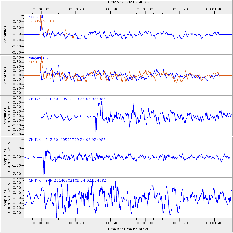
INK INUVIK, NT - Earthquake Result Viewer
*The percent match for this event was below the threshold and hence no stack was calculated.
| Earthquake location: |
Off East Coast Of Honshu, Japan |
| Earthquake latitude/longitude: |
37.9/144.2 |
| Earthquake time(UTC): |
2014/05/02 (122) 09:15:20 GMT |
| Earthquake Depth: |
15 km |
| Earthquake Magnitude: |
5.9 MWP |
| Earthquake Catalog/Contributor: |
NEIC PDE/NEIC COMCAT |
|
| Network: |
CN Canadian National Seismograph Network |
| Station: |
INK INUVIK, NT |
| Lat/Lon: |
68.31 N/133.53 W |
| Elevation: |
44 m |
|
| Distance: |
52.6 deg |
| Az: |
27.627 deg |
| Baz: |
279.272 deg |
| Ray Param: |
$rayparam |
*The percent match for this event was below the threshold and hence was not used in the summary stack. |
|
| Radial Match: |
61.51439 % |
| Radial Bump: |
400 |
| Transverse Match: |
57.73326 % |
| Transverse Bump: |
400 |
| SOD ConfigId: |
626651 |
| Insert Time: |
2014-05-16 09:29:02.152 +0000 |
| GWidth: |
2.5 |
| Max Bumps: |
400 |
| Tol: |
0.001 |
|
Signal To Noise
| Channel | StoN | STA | LTA |
| CN:INK: :BHZ:20140502T09:24:02.92498Z | 6.5037084 | 7.0120313E-7 | 1.0781589E-7 |
| CN:INK: :BHN:20140502T09:24:02.92498Z | 1.973182 | 1.4347968E-7 | 7.2714876E-8 |
| CN:INK: :BHE:20140502T09:24:02.92498Z | 4.163132 | 3.3810053E-7 | 8.121302E-8 |
| Arrivals |
| Ps | |
| PpPs | |
| PsPs/PpSs | |


