You are here: Home > Network List > TA - USArray Transportable Network (new EarthScope stations) Stations List
> Station G63A Kingsbury, ME, USA > Earthquake Result Viewer
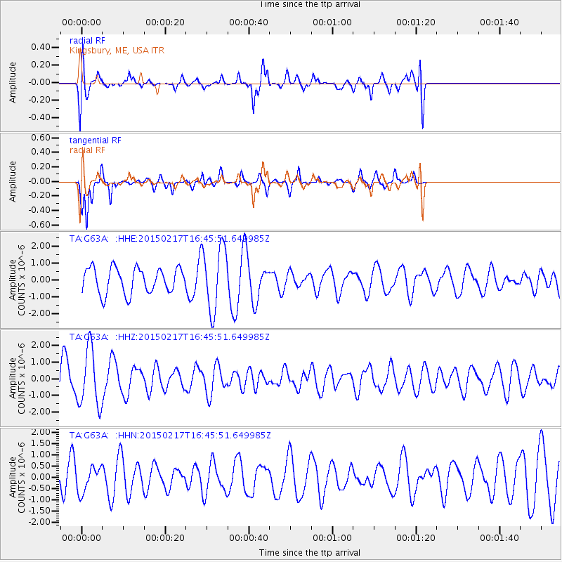
G63A Kingsbury, ME, USA - Earthquake Result Viewer
*The percent match for this event was below the threshold and hence no stack was calculated.
| Earthquake location: |
Off East Coast Of Honshu, Japan |
| Earthquake latitude/longitude: |
39.6/143.6 |
| Earthquake time(UTC): |
2015/02/17 (048) 16:33:21 GMT |
| Earthquake Depth: |
10 km |
| Earthquake Magnitude: |
5.5 MWW, 5.5 MWC, 5.5 MWB |
| Earthquake Catalog/Contributor: |
NEIC PDE/NEIC COMCAT |
|
| Network: |
TA USArray Transportable Network (new EarthScope stations) |
| Station: |
G63A Kingsbury, ME, USA |
| Lat/Lon: |
45.11 N/69.62 W |
| Elevation: |
363 m |
|
| Distance: |
90.6 deg |
| Az: |
22.813 deg |
| Baz: |
334.962 deg |
| Ray Param: |
$rayparam |
*The percent match for this event was below the threshold and hence was not used in the summary stack. |
|
| Radial Match: |
49.397 % |
| Radial Bump: |
400 |
| Transverse Match: |
82.33367 % |
| Transverse Bump: |
243 |
| SOD ConfigId: |
7019011 |
| Insert Time: |
2019-04-16 21:48:39.270 +0000 |
| GWidth: |
2.5 |
| Max Bumps: |
400 |
| Tol: |
0.001 |
|
Signal To Noise
| Channel | StoN | STA | LTA |
| TA:G63A: :HHZ:20150217T16:45:51.649985Z | 2.2396164 | 1.7620647E-6 | 7.867707E-7 |
| TA:G63A: :HHN:20150217T16:45:51.649985Z | 0.91565096 | 5.716186E-7 | 6.242757E-7 |
| TA:G63A: :HHE:20150217T16:45:51.649985Z | 2.4741626 | 1.8436655E-6 | 7.451675E-7 |
| Arrivals |
| Ps | |
| PpPs | |
| PsPs/PpSs | |


