You are here: Home > Network List > GS - US Geological Survey Networks Stations List
> Station DEC06 Boomer > Earthquake Result Viewer
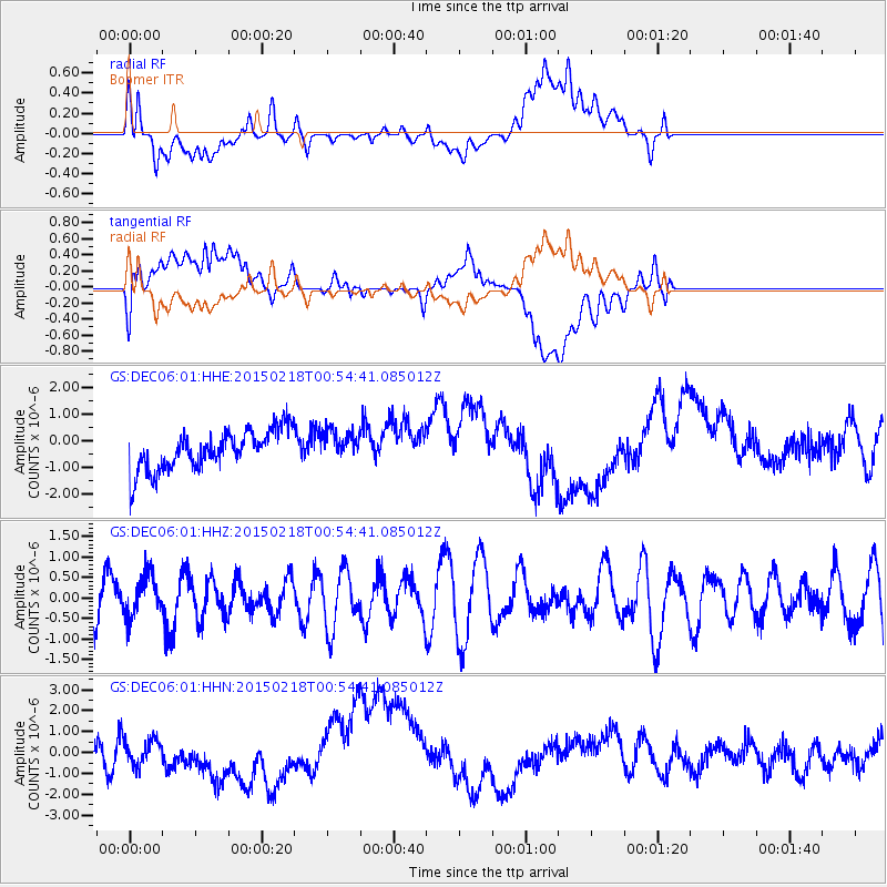
DEC06 Boomer - Earthquake Result Viewer
*The percent match for this event was below the threshold and hence no stack was calculated.
| Earthquake location: |
Northern East Pacific Rise |
| Earthquake latitude/longitude: |
8.4/-103.1 |
| Earthquake time(UTC): |
2015/02/18 (049) 00:48:31 GMT |
| Earthquake Depth: |
19 km |
| Earthquake Magnitude: |
5.6 MW |
| Earthquake Catalog/Contributor: |
ISC/ISC |
|
| Network: |
GS US Geological Survey Networks |
| Station: |
DEC06 Boomer |
| Lat/Lon: |
39.90 N/88.95 W |
| Elevation: |
215 m |
|
| Distance: |
33.8 deg |
| Az: |
19.799 deg |
| Baz: |
205.823 deg |
| Ray Param: |
$rayparam |
*The percent match for this event was below the threshold and hence was not used in the summary stack. |
|
| Radial Match: |
56.376015 % |
| Radial Bump: |
400 |
| Transverse Match: |
29.948442 % |
| Transverse Bump: |
400 |
| SOD ConfigId: |
7019011 |
| Insert Time: |
2019-04-16 21:56:00.999 +0000 |
| GWidth: |
2.5 |
| Max Bumps: |
400 |
| Tol: |
0.001 |
|
Signal To Noise
| Channel | StoN | STA | LTA |
| GS:DEC06:01:HHZ:20150218T00:54:41.085012Z | 0.89008033 | 5.01912E-7 | 5.638951E-7 |
| GS:DEC06:01:HHN:20150218T00:54:41.085012Z | 0.7014835 | 6.1136694E-7 | 8.715343E-7 |
| GS:DEC06:01:HHE:20150218T00:54:41.085012Z | 0.76751786 | 5.6957833E-7 | 7.4210436E-7 |
| Arrivals |
| Ps | |
| PpPs | |
| PsPs/PpSs | |


