You are here: Home > Network List > TA - USArray Transportable Network (new EarthScope stations) Stations List
> Station R53A Hurricane, WV, USA > Earthquake Result Viewer
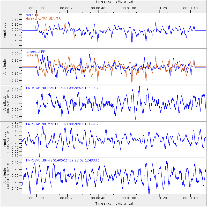
R53A Hurricane, WV, USA - Earthquake Result Viewer
*The percent match for this event was below the threshold and hence no stack was calculated.
| Earthquake location: |
Off East Coast Of Honshu, Japan |
| Earthquake latitude/longitude: |
37.9/144.2 |
| Earthquake time(UTC): |
2014/05/02 (122) 09:15:20 GMT |
| Earthquake Depth: |
15 km |
| Earthquake Magnitude: |
5.9 MWP |
| Earthquake Catalog/Contributor: |
NEIC PDE/NEIC COMCAT |
|
| Network: |
TA USArray Transportable Network (new EarthScope stations) |
| Station: |
R53A Hurricane, WV, USA |
| Lat/Lon: |
38.33 N/81.95 W |
| Elevation: |
294 m |
|
| Distance: |
93.0 deg |
| Az: |
34.64 deg |
| Baz: |
325.117 deg |
| Ray Param: |
$rayparam |
*The percent match for this event was below the threshold and hence was not used in the summary stack. |
|
| Radial Match: |
55.810585 % |
| Radial Bump: |
400 |
| Transverse Match: |
48.58866 % |
| Transverse Bump: |
400 |
| SOD ConfigId: |
626651 |
| Insert Time: |
2014-05-16 10:03:07.853 +0000 |
| GWidth: |
2.5 |
| Max Bumps: |
400 |
| Tol: |
0.001 |
|
Signal To Noise
| Channel | StoN | STA | LTA |
| TA:R53A: :BHZ:20140502T09:28:02.124993Z | 1.7873895 | 3.730562E-7 | 2.0871566E-7 |
| TA:R53A: :BHN:20140502T09:28:02.124993Z | 1.7369826 | 2.5217108E-7 | 1.4517767E-7 |
| TA:R53A: :BHE:20140502T09:28:02.124993Z | 0.6414078 | 1.0106117E-7 | 1.5756149E-7 |
| Arrivals |
| Ps | |
| PpPs | |
| PsPs/PpSs | |


