You are here: Home > Network List > TA - USArray Transportable Network (new EarthScope stations) Stations List
> Station U59A Littleton, NC, USA > Earthquake Result Viewer
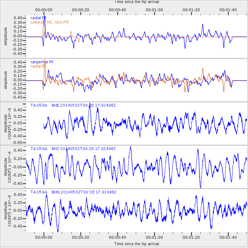
U59A Littleton, NC, USA - Earthquake Result Viewer
*The percent match for this event was below the threshold and hence no stack was calculated.
| Earthquake location: |
Off East Coast Of Honshu, Japan |
| Earthquake latitude/longitude: |
37.9/144.2 |
| Earthquake time(UTC): |
2014/05/02 (122) 09:15:20 GMT |
| Earthquake Depth: |
15 km |
| Earthquake Magnitude: |
5.9 MWP |
| Earthquake Catalog/Contributor: |
NEIC PDE/NEIC COMCAT |
|
| Network: |
TA USArray Transportable Network (new EarthScope stations) |
| Station: |
U59A Littleton, NC, USA |
| Lat/Lon: |
36.35 N/77.79 W |
| Elevation: |
99 m |
|
| Distance: |
96.5 deg |
| Az: |
32.963 deg |
| Baz: |
327.769 deg |
| Ray Param: |
$rayparam |
*The percent match for this event was below the threshold and hence was not used in the summary stack. |
|
| Radial Match: |
54.1225 % |
| Radial Bump: |
400 |
| Transverse Match: |
52.18405 % |
| Transverse Bump: |
400 |
| SOD ConfigId: |
626651 |
| Insert Time: |
2014-05-16 10:04:21.751 +0000 |
| GWidth: |
2.5 |
| Max Bumps: |
400 |
| Tol: |
0.001 |
|
Signal To Noise
| Channel | StoN | STA | LTA |
| TA:U59A: :BHZ:20140502T09:28:17.92498Z | 1.5133084 | 2.3554831E-7 | 1.5565122E-7 |
| TA:U59A: :BHN:20140502T09:28:17.92498Z | 1.9857033 | 2.4562286E-7 | 1.2369564E-7 |
| TA:U59A: :BHE:20140502T09:28:17.92498Z | 1.135177 | 2.0739313E-7 | 1.8269672E-7 |
| Arrivals |
| Ps | |
| PpPs | |
| PsPs/PpSs | |


