PFO Pinon Flat, California, USA - Earthquake Result Viewer
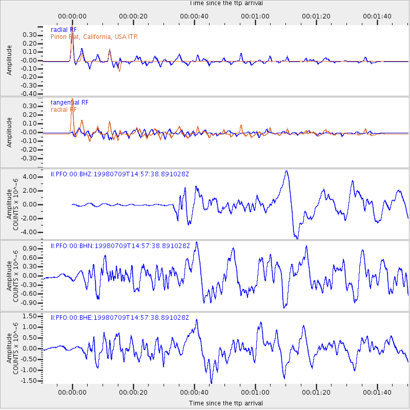
Earthquake location: Kermadec Islands, New Zealand
Earthquake latitude/longitude: -30.5/-179.0
Earthquake time(UTC): 1998/07/09 (190) 14:45:39 GMT
Earthquake Depth: 130 km
Earthquake Magnitude: 6.2 MB, 6.2 MS, 6.9 UNKNOWN, 6.4 ME
Earthquake Catalog/Contributor: WHDF/NEIC
Network: II Global Seismograph Network (GSN - IRIS/IDA)
Station: PFO Pinon Flat, California, USA
Lat/Lon: 33.61 N/116.46 W
Elevation: 1280 m
Distance: 86.9 deg
Az: 47.867 deg
Baz: 230.093 deg
Ray Param: 0.043428082
Estimated Moho Depth: 30.0 km
Estimated Crust Vp/Vs: 1.60
Assumed Crust Vp: 6.264 km/s
Estimated Crust Vs: 3.915 km/s
Estimated Crust Poisson's Ratio: 0.18
Radial Match: 93.80269 %
Radial Bump: 331
Transverse Match: 86.07359 %
Transverse Bump: 400
SOD ConfigId: 9875
Insert Time: 2010-03-01 21:40:22.653 +0000
GWidth: 2.5
Max Bumps: 400
Tol: 0.001

Signal To Noise

ChannelStoNSTALTA
II:PFO:00:BHN:19980709T14:57:38.891028Z2.57326561.628581E-76.328849E-8
II:PFO:00:BHE:19980709T14:57:38.891028Z2.18036131.4499335E-76.6499695E-8
II:PFO:00:BHZ:19980709T14:57:38.891028Z5.81850057.0407776E-71.2100674E-7
Arrivals
Ps2.9 SECOND
PpPs12 SECOND
PsPs/PpSs15 SECOND