You are here: Home > Network List > US - United States National Seismic Network Stations List
> Station DUG Dugway, Tooele County, Utah, USA > Earthquake Result Viewer
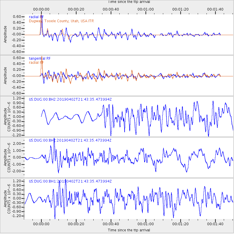
DUG Dugway, Tooele County, Utah, USA - Earthquake Result Viewer
*The percent match for this event was below the threshold and hence no stack was calculated.
| Earthquake location: |
Rat Islands, Aleutian Islands |
| Earthquake latitude/longitude: |
52.2/178.1 |
| Earthquake time(UTC): |
2019/04/02 (092) 21:35:30 GMT |
| Earthquake Depth: |
6.5 km |
| Earthquake Magnitude: |
6.4 mww |
| Earthquake Catalog/Contributor: |
NEIC PDE/us |
|
| Network: |
US United States National Seismic Network |
| Station: |
DUG Dugway, Tooele County, Utah, USA |
| Lat/Lon: |
40.19 N/112.81 W |
| Elevation: |
1477 m |
|
| Distance: |
47.6 deg |
| Az: |
75.808 deg |
| Baz: |
308.761 deg |
| Ray Param: |
$rayparam |
*The percent match for this event was below the threshold and hence was not used in the summary stack. |
|
| Radial Match: |
77.00845 % |
| Radial Bump: |
400 |
| Transverse Match: |
65.61399 % |
| Transverse Bump: |
400 |
| SOD ConfigId: |
7164631 |
| Insert Time: |
2019-04-16 22:01:09.078 +0000 |
| GWidth: |
2.5 |
| Max Bumps: |
400 |
| Tol: |
0.001 |
|
Signal To Noise
| Channel | StoN | STA | LTA |
| US:DUG:00:BHZ:20190402T21:43:35.473994Z | 2.1919012 | 3.5336757E-7 | 1.6121508E-7 |
| US:DUG:00:BH1:20190402T21:43:35.473994Z | 0.5498743 | 1.4411769E-7 | 2.6209207E-7 |
| US:DUG:00:BH2:20190402T21:43:35.473994Z | 0.80022204 | 1.662376E-7 | 2.0773935E-7 |
| Arrivals |
| Ps | |
| PpPs | |
| PsPs/PpSs | |


