You are here: Home > Network List > US - United States National Seismic Network Stations List
> Station HAWA Hanford, Washington, USA > Earthquake Result Viewer
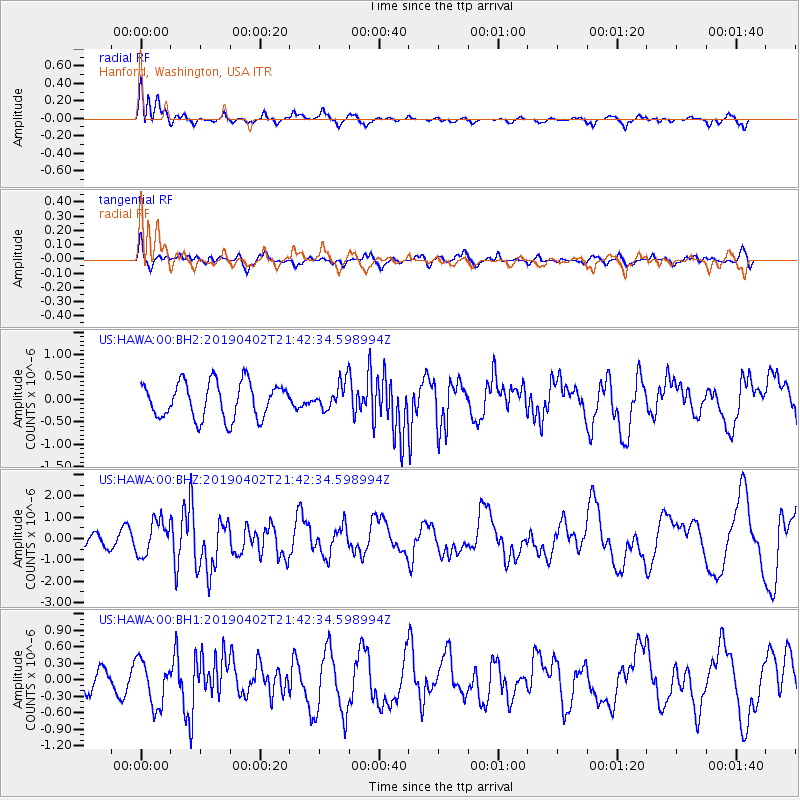
HAWA Hanford, Washington, USA - Earthquake Result Viewer
*The percent match for this event was below the threshold and hence no stack was calculated.
| Earthquake location: |
Rat Islands, Aleutian Islands |
| Earthquake latitude/longitude: |
52.2/178.1 |
| Earthquake time(UTC): |
2019/04/02 (092) 21:35:30 GMT |
| Earthquake Depth: |
6.5 km |
| Earthquake Magnitude: |
6.4 mww |
| Earthquake Catalog/Contributor: |
NEIC PDE/us |
|
| Network: |
US United States National Seismic Network |
| Station: |
HAWA Hanford, Washington, USA |
| Lat/Lon: |
46.39 N/119.53 W |
| Elevation: |
364 m |
|
| Distance: |
40.0 deg |
| Az: |
72.613 deg |
| Baz: |
301.848 deg |
| Ray Param: |
$rayparam |
*The percent match for this event was below the threshold and hence was not used in the summary stack. |
|
| Radial Match: |
71.07926 % |
| Radial Bump: |
400 |
| Transverse Match: |
55.212486 % |
| Transverse Bump: |
400 |
| SOD ConfigId: |
7164631 |
| Insert Time: |
2019-04-16 22:01:14.457 +0000 |
| GWidth: |
2.5 |
| Max Bumps: |
400 |
| Tol: |
0.001 |
|
Signal To Noise
| Channel | StoN | STA | LTA |
| US:HAWA:00:BHZ:20190402T21:42:34.598994Z | 2.4540586 | 8.0453407E-7 | 3.2783817E-7 |
| US:HAWA:00:BH1:20190402T21:42:34.598994Z | 2.615423 | 4.1495102E-7 | 1.5865542E-7 |
| US:HAWA:00:BH2:20190402T21:42:34.598994Z | 0.7438791 | 2.959154E-7 | 3.9780042E-7 |
| Arrivals |
| Ps | |
| PpPs | |
| PsPs/PpSs | |


