You are here: Home > Network List > GS - US Geological Survey Networks Stations List
> Station KAN13 Rinehart Farm > Earthquake Result Viewer
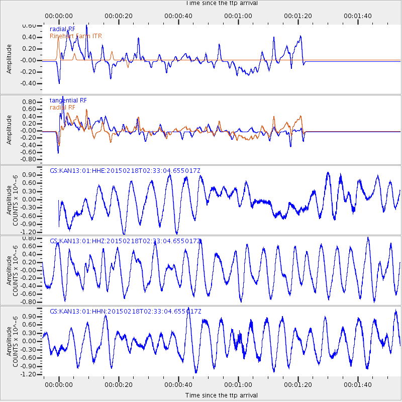
KAN13 Rinehart Farm - Earthquake Result Viewer
*The percent match for this event was below the threshold and hence no stack was calculated.
| Earthquake location: |
Ascension Island Region |
| Earthquake latitude/longitude: |
-7.7/-13.4 |
| Earthquake time(UTC): |
2015/02/18 (049) 02:20:37 GMT |
| Earthquake Depth: |
10 km |
| Earthquake Magnitude: |
5.2 MW |
| Earthquake Catalog/Contributor: |
ISC/ISC |
|
| Network: |
GS US Geological Survey Networks |
| Station: |
KAN13 Rinehart Farm |
| Lat/Lon: |
37.01 N/97.48 W |
| Elevation: |
340 m |
|
| Distance: |
89.8 deg |
| Az: |
307.24 deg |
| Baz: |
99.661 deg |
| Ray Param: |
$rayparam |
*The percent match for this event was below the threshold and hence was not used in the summary stack. |
|
| Radial Match: |
57.859543 % |
| Radial Bump: |
400 |
| Transverse Match: |
60.603725 % |
| Transverse Bump: |
400 |
| SOD ConfigId: |
7019011 |
| Insert Time: |
2019-04-16 22:09:25.968 +0000 |
| GWidth: |
2.5 |
| Max Bumps: |
400 |
| Tol: |
0.001 |
|
Signal To Noise
| Channel | StoN | STA | LTA |
| GS:KAN13:01:HHZ:20150218T02:33:04.655017Z | 1.1854869 | 4.7810494E-7 | 4.032984E-7 |
| GS:KAN13:01:HHN:20150218T02:33:04.655017Z | 0.5781751 | 4.5120308E-7 | 7.8039176E-7 |
| GS:KAN13:01:HHE:20150218T02:33:04.655017Z | 1.2836585 | 6.134138E-7 | 4.778637E-7 |
| Arrivals |
| Ps | |
| PpPs | |
| PsPs/PpSs | |


