You are here: Home > Network List > TA - USArray Transportable Network (new EarthScope stations) Stations List
> Station N47A Urbana, IN, USA > Earthquake Result Viewer
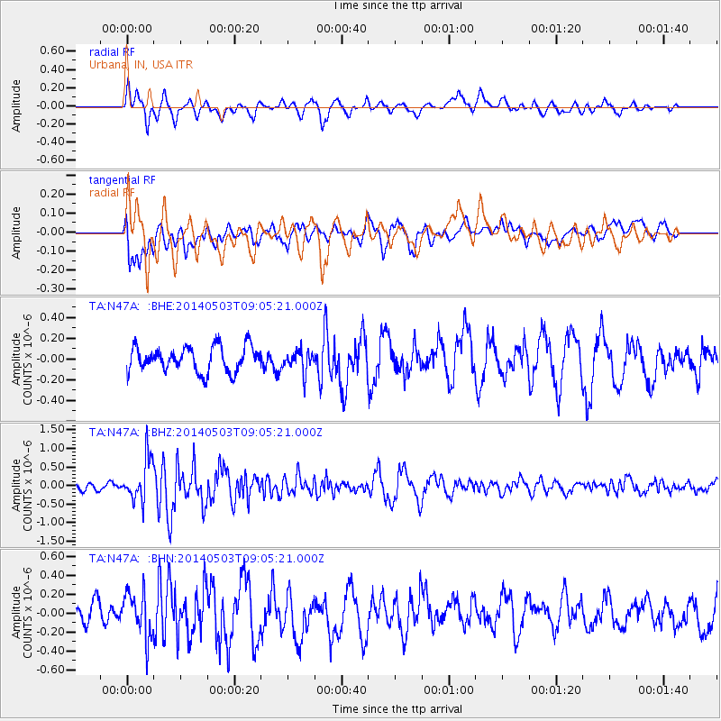
N47A Urbana, IN, USA - Earthquake Result Viewer
*The percent match for this event was below the threshold and hence no stack was calculated.
| Earthquake location: |
Northern Alaska |
| Earthquake latitude/longitude: |
67.6/-162.2 |
| Earthquake time(UTC): |
2014/05/03 (123) 08:57:12 GMT |
| Earthquake Depth: |
0.9 km |
| Earthquake Magnitude: |
5.5 MB |
| Earthquake Catalog/Contributor: |
NEIC PDE/NEIC COMCAT |
|
| Network: |
TA USArray Transportable Network (new EarthScope stations) |
| Station: |
N47A Urbana, IN, USA |
| Lat/Lon: |
40.88 N/85.69 W |
| Elevation: |
252 m |
|
| Distance: |
47.9 deg |
| Az: |
83.334 deg |
| Baz: |
329.907 deg |
| Ray Param: |
$rayparam |
*The percent match for this event was below the threshold and hence was not used in the summary stack. |
|
| Radial Match: |
68.84198 % |
| Radial Bump: |
400 |
| Transverse Match: |
58.117268 % |
| Transverse Bump: |
400 |
| SOD ConfigId: |
626651 |
| Insert Time: |
2014-05-17 09:44:00.794 +0000 |
| GWidth: |
2.5 |
| Max Bumps: |
400 |
| Tol: |
0.001 |
|
Signal To Noise
| Channel | StoN | STA | LTA |
| TA:N47A: :BHZ:20140503T09:05:21.000Z | 4.218437 | 5.7719313E-7 | 1.3682629E-7 |
| TA:N47A: :BHN:20140503T09:05:21.000Z | 1.639087 | 2.389892E-7 | 1.458063E-7 |
| TA:N47A: :BHE:20140503T09:05:21.000Z | 0.8358546 | 1.02415044E-7 | 1.2252735E-7 |
| Arrivals |
| Ps | |
| PpPs | |
| PsPs/PpSs | |


