You are here: Home > Network List > AK - Alaska Regional Network Stations List
> Station MDM Murphy Dome > Earthquake Result Viewer
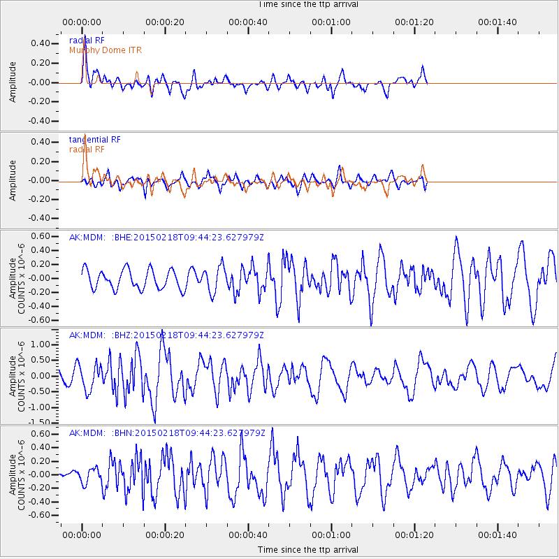
MDM Murphy Dome - Earthquake Result Viewer
*The percent match for this event was below the threshold and hence no stack was calculated.
| Earthquake location: |
Santa Cruz Islands Region |
| Earthquake latitude/longitude: |
-10.7/164.2 |
| Earthquake time(UTC): |
2015/02/18 (049) 09:32:26 GMT |
| Earthquake Depth: |
10 km |
| Earthquake Magnitude: |
5.9 MB |
| Earthquake Catalog/Contributor: |
NEIC PDE/NEIC COMCAT |
|
| Network: |
AK Alaska Regional Network |
| Station: |
MDM Murphy Dome |
| Lat/Lon: |
64.96 N/148.23 W |
| Elevation: |
634 m |
|
| Distance: |
83.4 deg |
| Az: |
18.45 deg |
| Baz: |
226.948 deg |
| Ray Param: |
$rayparam |
*The percent match for this event was below the threshold and hence was not used in the summary stack. |
|
| Radial Match: |
66.27279 % |
| Radial Bump: |
400 |
| Transverse Match: |
67.22518 % |
| Transverse Bump: |
400 |
| SOD ConfigId: |
7019011 |
| Insert Time: |
2019-04-16 22:22:39.184 +0000 |
| GWidth: |
2.5 |
| Max Bumps: |
400 |
| Tol: |
0.001 |
|
Signal To Noise
| Channel | StoN | STA | LTA |
| AK:MDM: :BHZ:20150218T09:44:23.627979Z | 2.9292173 | 4.0686237E-7 | 1.3889797E-7 |
| AK:MDM: :BHN:20150218T09:44:23.627979Z | 0.7284402 | 1.09097655E-7 | 1.4976885E-7 |
| AK:MDM: :BHE:20150218T09:44:23.627979Z | 1.4043133 | 1.8622971E-7 | 1.3261266E-7 |
| Arrivals |
| Ps | |
| PpPs | |
| PsPs/PpSs | |


