You are here: Home > Network List > AV - Alaska Volcano Observatory Stations List
> Station AMKA Regional Station, Amchitka Island, Alaska > Earthquake Result Viewer
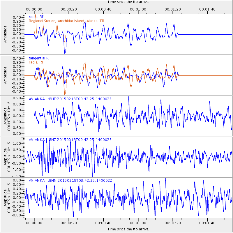
AMKA Regional Station, Amchitka Island, Alaska - Earthquake Result Viewer
*The percent match for this event was below the threshold and hence no stack was calculated.
| Earthquake location: |
Santa Cruz Islands Region |
| Earthquake latitude/longitude: |
-10.7/164.2 |
| Earthquake time(UTC): |
2015/02/18 (049) 09:32:26 GMT |
| Earthquake Depth: |
10 km |
| Earthquake Magnitude: |
5.9 MB |
| Earthquake Catalog/Contributor: |
NEIC PDE/NEIC COMCAT |
|
| Network: |
AV Alaska Volcano Observatory |
| Station: |
AMKA Regional Station, Amchitka Island, Alaska |
| Lat/Lon: |
51.38 N/179.30 E |
| Elevation: |
116 m |
|
| Distance: |
63.2 deg |
| Az: |
10.572 deg |
| Baz: |
196.719 deg |
| Ray Param: |
$rayparam |
*The percent match for this event was below the threshold and hence was not used in the summary stack. |
|
| Radial Match: |
60.013245 % |
| Radial Bump: |
400 |
| Transverse Match: |
64.677956 % |
| Transverse Bump: |
400 |
| SOD ConfigId: |
7019011 |
| Insert Time: |
2019-04-16 22:22:59.688 +0000 |
| GWidth: |
2.5 |
| Max Bumps: |
400 |
| Tol: |
0.001 |
|
Signal To Noise
| Channel | StoN | STA | LTA |
| AV:AMKA: :BHZ:20150218T09:42:25.140002Z | 2.0557766 | 4.1072323E-7 | 1.9978981E-7 |
| AV:AMKA: :BHN:20150218T09:42:25.140002Z | 0.84997827 | 1.9293361E-7 | 2.2698653E-7 |
| AV:AMKA: :BHE:20150218T09:42:25.140002Z | 0.8723875 | 2.159746E-7 | 2.4756727E-7 |
| Arrivals |
| Ps | |
| PpPs | |
| PsPs/PpSs | |


