PFO Pinon Flat, California, USA - Earthquake Result Viewer
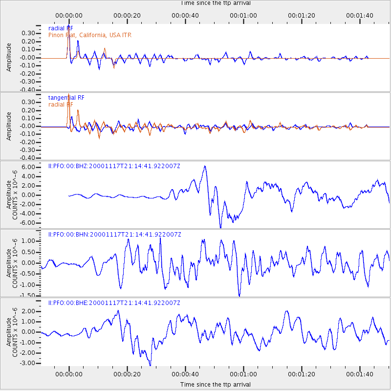
Earthquake location: New Britain Region, P.N.G.
Earthquake latitude/longitude: -5.5/151.8
Earthquake time(UTC): 2000/11/17 (322) 21:01:56 GMT
Earthquake Depth: 33 km
Earthquake Magnitude: 6.2 MB, 8.0 MS, 7.6 MW, 6.9 ME
Earthquake Catalog/Contributor: WHDF/NEIC
Network: II Global Seismograph Network (GSN - IRIS/IDA)
Station: PFO Pinon Flat, California, USA
Lat/Lon: 33.61 N/116.46 W
Elevation: 1280 m
Distance: 94.5 deg
Az: 56.793 deg
Baz: 266.405 deg
Ray Param: 0.041022524
Estimated Moho Depth: 29.0 km
Estimated Crust Vp/Vs: 1.68
Assumed Crust Vp: 6.264 km/s
Estimated Crust Vs: 3.723 km/s
Estimated Crust Poisson's Ratio: 0.23
Radial Match: 94.39438 %
Radial Bump: 322
Transverse Match: 75.768074 %
Transverse Bump: 400
SOD ConfigId: 3744
Insert Time: 2010-03-01 21:43:54.274 +0000
GWidth: 2.5
Max Bumps: 400
Tol: 0.001

Signal To Noise

ChannelStoNSTALTA
II:PFO:00:BHN:20001117T21:14:41.922007Z0.506852277.662113E-81.5117054E-7
II:PFO:00:BHE:20001117T21:14:41.922007Z1.50013481.64279E-71.09509486E-7
II:PFO:00:BHZ:20001117T21:14:41.922007Z1.48961033.858348E-72.5901727E-7
Arrivals
Ps3.2 SECOND
PpPs12 SECOND
PsPs/PpSs15 SECOND