You are here: Home > Network List > TA - USArray Transportable Network (new EarthScope stations) Stations List
> Station G03D McMinnville, OR, USA > Earthquake Result Viewer
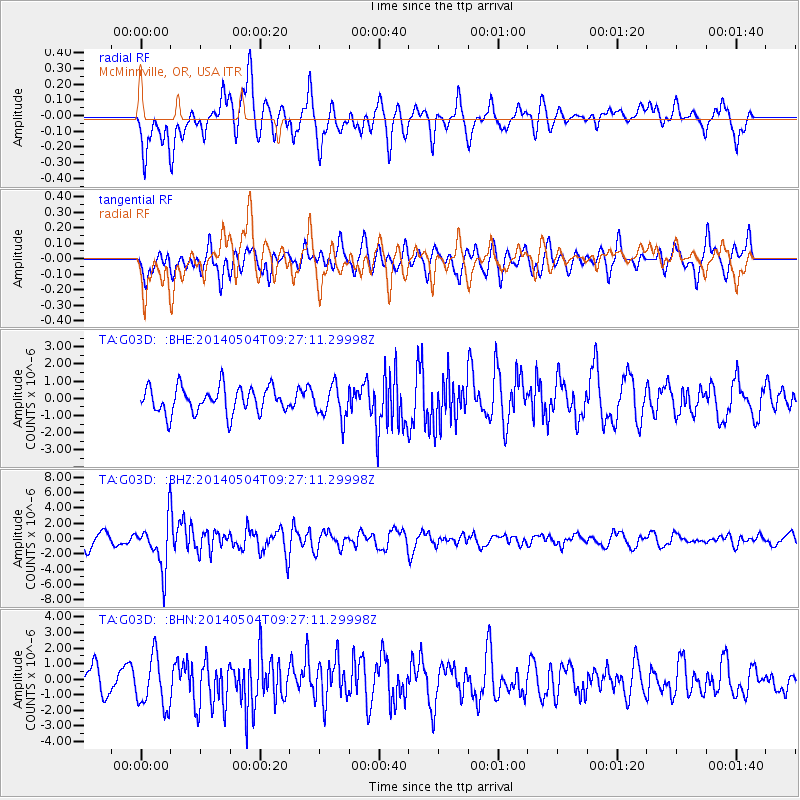
G03D McMinnville, OR, USA - Earthquake Result Viewer
*The percent match for this event was below the threshold and hence no stack was calculated.
| Earthquake location: |
South Of Fiji Islands |
| Earthquake latitude/longitude: |
-24.6/179.1 |
| Earthquake time(UTC): |
2014/05/04 (124) 09:15:53 GMT |
| Earthquake Depth: |
528 km |
| Earthquake Magnitude: |
6.6 MWP, 6.8 MI |
| Earthquake Catalog/Contributor: |
NEIC PDE/NEIC COMCAT |
|
| Network: |
TA USArray Transportable Network (new EarthScope stations) |
| Station: |
G03D McMinnville, OR, USA |
| Lat/Lon: |
45.21 N/123.26 W |
| Elevation: |
222 m |
|
| Distance: |
87.1 deg |
| Az: |
36.723 deg |
| Baz: |
230.333 deg |
| Ray Param: |
$rayparam |
*The percent match for this event was below the threshold and hence was not used in the summary stack. |
|
| Radial Match: |
66.656586 % |
| Radial Bump: |
400 |
| Transverse Match: |
60.978527 % |
| Transverse Bump: |
400 |
| SOD ConfigId: |
626651 |
| Insert Time: |
2014-05-18 10:02:53.804 +0000 |
| GWidth: |
2.5 |
| Max Bumps: |
400 |
| Tol: |
0.001 |
|
Signal To Noise
| Channel | StoN | STA | LTA |
| TA:G03D: :BHZ:20140504T09:27:11.29998Z | 3.404818 | 3.1457298E-6 | 9.2390536E-7 |
| TA:G03D: :BHN:20140504T09:27:11.29998Z | 1.8828481 | 1.6351083E-6 | 8.684228E-7 |
| TA:G03D: :BHE:20140504T09:27:11.29998Z | 1.2557876 | 9.545076E-7 | 7.600868E-7 |
| Arrivals |
| Ps | |
| PpPs | |
| PsPs/PpSs | |


