You are here: Home > Network List > TA - USArray Transportable Network (new EarthScope stations) Stations List
> Station MSTX Muleshoe, TX, USA > Earthquake Result Viewer
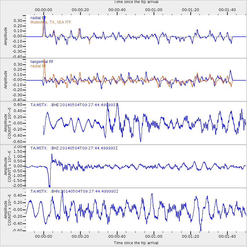
MSTX Muleshoe, TX, USA - Earthquake Result Viewer
*The percent match for this event was below the threshold and hence no stack was calculated.
| Earthquake location: |
South Of Fiji Islands |
| Earthquake latitude/longitude: |
-24.6/179.1 |
| Earthquake time(UTC): |
2014/05/04 (124) 09:15:53 GMT |
| Earthquake Depth: |
528 km |
| Earthquake Magnitude: |
6.6 MWP, 6.8 MI |
| Earthquake Catalog/Contributor: |
NEIC PDE/NEIC COMCAT |
|
| Network: |
TA USArray Transportable Network (new EarthScope stations) |
| Station: |
MSTX Muleshoe, TX, USA |
| Lat/Lon: |
33.97 N/102.77 W |
| Elevation: |
1167 m |
|
| Distance: |
94.3 deg |
| Az: |
54.652 deg |
| Baz: |
243.266 deg |
| Ray Param: |
$rayparam |
*The percent match for this event was below the threshold and hence was not used in the summary stack. |
|
| Radial Match: |
51.97073 % |
| Radial Bump: |
346 |
| Transverse Match: |
45.761524 % |
| Transverse Bump: |
300 |
| SOD ConfigId: |
626651 |
| Insert Time: |
2014-05-18 10:04:01.158 +0000 |
| GWidth: |
2.5 |
| Max Bumps: |
400 |
| Tol: |
0.001 |
|
Signal To Noise
| Channel | StoN | STA | LTA |
| TA:MSTX: :BHZ:20140504T09:27:44.499993Z | 10.973911 | 8.889122E-7 | 8.100231E-8 |
| TA:MSTX: :BHN:20140504T09:27:44.499993Z | 1.6098841 | 2.476911E-7 | 1.5385649E-7 |
| TA:MSTX: :BHE:20140504T09:27:44.499993Z | 1.5295227 | 2.3295064E-7 | 1.5230285E-7 |
| Arrivals |
| Ps | |
| PpPs | |
| PsPs/PpSs | |


