PFO Pinon Flat, California, USA - Earthquake Result Viewer
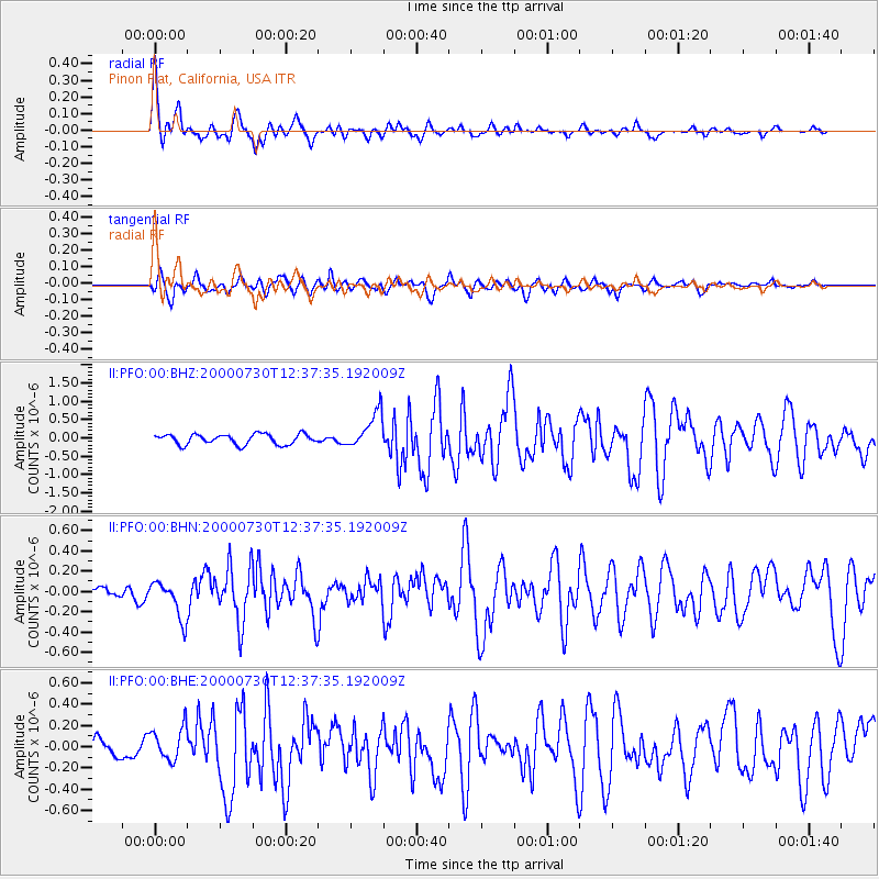
Earthquake location: Southeast Of Honshu, Japan
Earthquake latitude/longitude: 33.9/139.4
Earthquake time(UTC): 2000/07/30 (212) 12:25:45 GMT
Earthquake Depth: 10 km
Earthquake Magnitude: 6.0 MB, 6.5 MS, 6.5 MW, 6.5 MW
Earthquake Catalog/Contributor: WHDF/NEIC
Network: II Global Seismograph Network (GSN - IRIS/IDA)
Station: PFO Pinon Flat, California, USA
Lat/Lon: 33.61 N/116.46 W
Elevation: 1280 m
Distance: 82.2 deg
Az: 54.76 deg
Baz: 305.513 deg
Ray Param: 0.04706248
Estimated Moho Depth: 29.75 km
Estimated Crust Vp/Vs: 1.76
Assumed Crust Vp: 6.264 km/s
Estimated Crust Vs: 3.554 km/s
Estimated Crust Poisson's Ratio: 0.26
Radial Match: 93.44924 %
Radial Bump: 400
Transverse Match: 65.931404 %
Transverse Bump: 400
SOD ConfigId: 3744
Insert Time: 2010-03-01 21:44:28.076 +0000
GWidth: 2.5
Max Bumps: 400
Tol: 0.001

Signal To Noise

ChannelStoNSTALTA
II:PFO:00:BHN:20000730T12:37:35.192009Z1.90709351.8459265E-79.679266E-8
II:PFO:00:BHE:20000730T12:37:35.192009Z2.00145911.595172E-77.970045E-8
II:PFO:00:BHZ:20000730T12:37:35.192009Z3.5248124.951815E-71.4048452E-7
Arrivals
Ps3.7 SECOND
PpPs13 SECOND
PsPs/PpSs17 SECOND