You are here: Home > Network List > UW - Pacific Northwest Regional Seismic Network Stations List
> Station LEBA Lebam, WA, USA > Earthquake Result Viewer
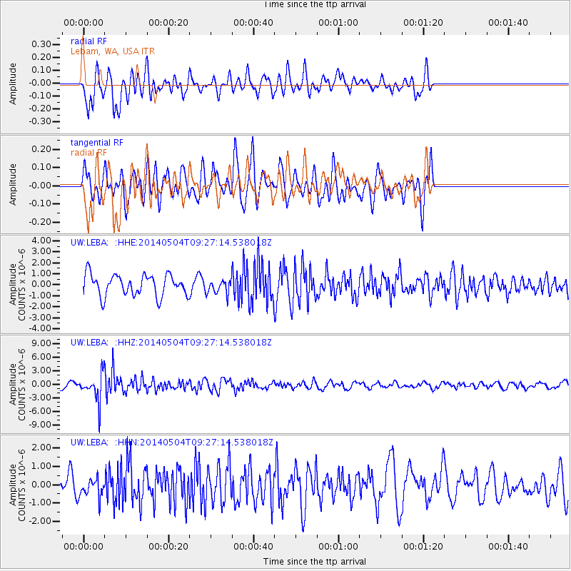
LEBA Lebam, WA, USA - Earthquake Result Viewer
*The percent match for this event was below the threshold and hence no stack was calculated.
| Earthquake location: |
South Of Fiji Islands |
| Earthquake latitude/longitude: |
-24.6/179.1 |
| Earthquake time(UTC): |
2014/05/04 (124) 09:15:53 GMT |
| Earthquake Depth: |
528 km |
| Earthquake Magnitude: |
6.6 MWP, 6.8 MI |
| Earthquake Catalog/Contributor: |
NEIC PDE/NEIC COMCAT |
|
| Network: |
UW Pacific Northwest Regional Seismic Network |
| Station: |
LEBA Lebam, WA, USA |
| Lat/Lon: |
46.55 N/123.56 W |
| Elevation: |
73 m |
|
| Distance: |
87.8 deg |
| Az: |
35.563 deg |
| Baz: |
230.067 deg |
| Ray Param: |
$rayparam |
*The percent match for this event was below the threshold and hence was not used in the summary stack. |
|
| Radial Match: |
46.691246 % |
| Radial Bump: |
400 |
| Transverse Match: |
46.197186 % |
| Transverse Bump: |
400 |
| SOD ConfigId: |
626651 |
| Insert Time: |
2014-05-18 10:09:35.999 +0000 |
| GWidth: |
2.5 |
| Max Bumps: |
400 |
| Tol: |
0.001 |
|
Signal To Noise
| Channel | StoN | STA | LTA |
| UW:LEBA: :HHZ:20140504T09:27:14.538018Z | 4.6954093 | 3.0050826E-6 | 6.400044E-7 |
| UW:LEBA: :HHN:20140504T09:27:14.538018Z | 0.83294684 | 4.91514E-7 | 5.900905E-7 |
| UW:LEBA: :HHE:20140504T09:27:14.538018Z | 0.66676205 | 6.3964654E-7 | 9.593325E-7 |
| Arrivals |
| Ps | |
| PpPs | |
| PsPs/PpSs | |


