You are here: Home > Network List > AZ - ANZA Regional Network Stations List
> Station SMER AZ.SMER > Earthquake Result Viewer
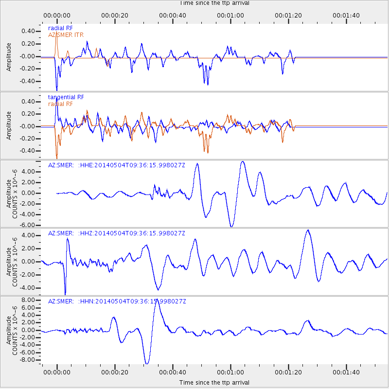
SMER AZ.SMER - Earthquake Result Viewer
*The percent match for this event was below the threshold and hence no stack was calculated.
| Earthquake location: |
South Of Fiji Islands |
| Earthquake latitude/longitude: |
-25.8/178.2 |
| Earthquake time(UTC): |
2014/05/04 (124) 09:25:14 GMT |
| Earthquake Depth: |
611 km |
| Earthquake Magnitude: |
6.1 MB |
| Earthquake Catalog/Contributor: |
NEIC PDE/NEIC COMCAT |
|
| Network: |
AZ ANZA Regional Network |
| Station: |
SMER AZ.SMER |
| Lat/Lon: |
33.46 N/117.17 W |
| Elevation: |
355 m |
|
| Distance: |
85.1 deg |
| Az: |
49.296 deg |
| Baz: |
234.833 deg |
| Ray Param: |
$rayparam |
*The percent match for this event was below the threshold and hence was not used in the summary stack. |
|
| Radial Match: |
27.8474 % |
| Radial Bump: |
262 |
| Transverse Match: |
35.59326 % |
| Transverse Bump: |
400 |
| SOD ConfigId: |
626651 |
| Insert Time: |
2014-05-18 10:22:40.702 +0000 |
| GWidth: |
2.5 |
| Max Bumps: |
400 |
| Tol: |
0.001 |
|
Signal To Noise
| Channel | StoN | STA | LTA |
| AZ:SMER: :HHZ:20140504T09:36:15.998027Z | 4.7495174 | 1.8979389E-6 | 3.9960668E-7 |
| AZ:SMER: :HHN:20140504T09:36:15.998027Z | 1.6720842 | 3.1969887E-7 | 1.9119781E-7 |
| AZ:SMER: :HHE:20140504T09:36:15.998027Z | 1.4467921 | 5.690587E-7 | 3.9332448E-7 |
| Arrivals |
| Ps | |
| PpPs | |
| PsPs/PpSs | |


