You are here: Home > Network List > II - Global Seismograph Network (GSN - IRIS/IDA) Stations List
> Station PFO Pinon Flat, California, USA > Earthquake Result Viewer
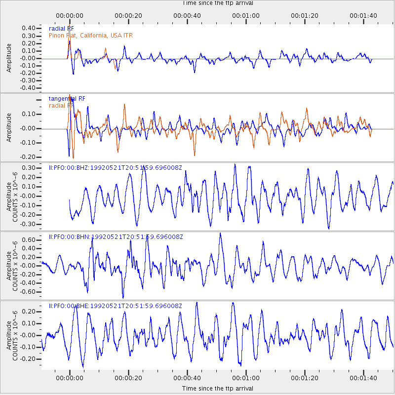
PFO Pinon Flat, California, USA - Earthquake Result Viewer
*The percent match for this event was below the threshold and hence no stack was calculated.
| Earthquake location: |
Southeast Of Honshu, Japan |
| Earthquake latitude/longitude: |
31.0/141.7 |
| Earthquake time(UTC): |
1992/05/21 (142) 20:40:13 GMT |
| Earthquake Depth: |
33 km |
| Earthquake Magnitude: |
5.5 MB, 5.7 MS |
| Earthquake Catalog/Contributor: |
WHDF/NEIC |
|
| Network: |
II Global Seismograph Network (GSN - IRIS/IDA) |
| Station: |
PFO Pinon Flat, California, USA |
| Lat/Lon: |
33.61 N/116.46 W |
| Elevation: |
1280 m |
|
| Distance: |
82.2 deg |
| Az: |
55.538 deg |
| Baz: |
301.973 deg |
| Ray Param: |
$rayparam |
*The percent match for this event was below the threshold and hence was not used in the summary stack. |
|
| Radial Match: |
54.01808 % |
| Radial Bump: |
400 |
| Transverse Match: |
53.85315 % |
| Transverse Bump: |
400 |
| SOD ConfigId: |
4480 |
| Insert Time: |
2010-03-01 21:45:50.387 +0000 |
| GWidth: |
2.5 |
| Max Bumps: |
400 |
| Tol: |
0.001 |
|
Signal To Noise
| Channel | StoN | STA | LTA |
| II:PFO:00:BHN:19920521T20:51:59.696008Z | 0.4432912 | 8.0364444E-8 | 1.8129042E-7 |
| II:PFO:00:BHE:19920521T20:51:59.696008Z | 1.7192941 | 1.724092E-7 | 1.0027907E-7 |
| II:PFO:00:BHZ:19920521T20:51:59.696008Z | 0.7268342 | 9.966835E-8 | 1.3712668E-7 |
| Arrivals |
| Ps | |
| PpPs | |
| PsPs/PpSs | |


