You are here: Home > Network List > II - Global Seismograph Network (GSN - IRIS/IDA) Stations List
> Station PFO Pinon Flat, California, USA > Earthquake Result Viewer
PFO Pinon Flat, California, USA - Earthquake Result Viewer
*The percent match for this event was below the threshold and hence no stack was calculated.
| Earthquake location: |
West Of Bonin Islands |
| Earthquake latitude/longitude: |
28.2/134.2 |
| Earthquake time(UTC): |
1992/06/01 (153) 18:29:15 GMT |
| Earthquake Depth: |
33 km |
| Earthquake Magnitude: |
5.7 MB, 4.4 MS |
| Earthquake Catalog/Contributor: |
WHDF/NEIC |
|
| Network: |
II Global Seismograph Network (GSN - IRIS/IDA) |
| Station: |
PFO Pinon Flat, California, USA |
| Lat/Lon: |
33.61 N/116.46 W |
| Elevation: |
1280 m |
|
| Distance: |
89.1 deg |
| Az: |
51.971 deg |
| Baz: |
303.603 deg |
| Ray Param: |
$rayparam |
*The percent match for this event was below the threshold and hence was not used in the summary stack. |
|
| Radial Match: |
49.560413 % |
| Radial Bump: |
400 |
| Transverse Match: |
68.08963 % |
| Transverse Bump: |
400 |
| SOD ConfigId: |
4480 |
| Insert Time: |
2010-03-01 21:45:57.495 +0000 |
| GWidth: |
2.5 |
| Max Bumps: |
400 |
| Tol: |
0.001 |
|
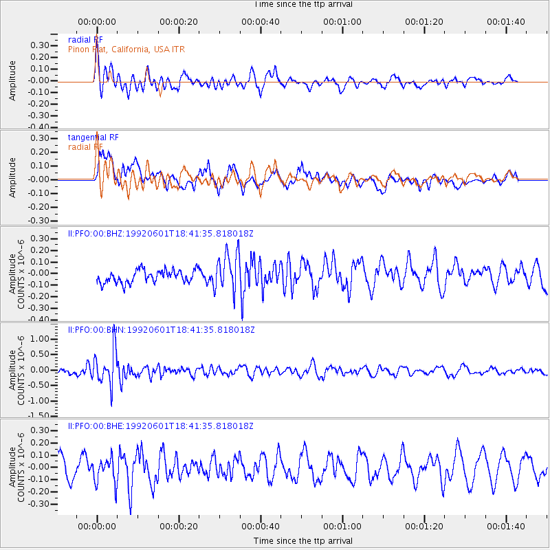
Signal To Noise
| Channel | StoN | STA | LTA |
| II:PFO:00:BHN:19920601T18:41:35.818018Z | 5.4756575 | 5.672651E-7 | 1.0359763E-7 |
| II:PFO:00:BHE:19920601T18:41:35.818018Z | 1.2879136 | 1.03438644E-7 | 8.03149E-8 |
| II:PFO:00:BHZ:19920601T18:41:35.818018Z | 3.1226041 | 1.6910505E-7 | 5.4155134E-8 |
| Arrivals |
| Ps | |
| PpPs | |
| PsPs/PpSs | |


