You are here: Home > Network List > TA - USArray Transportable Network (new EarthScope stations) Stations List
> Station Y12C Blythe, CA, USA > Earthquake Result Viewer
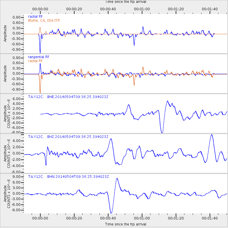
Y12C Blythe, CA, USA - Earthquake Result Viewer
*The percent match for this event was below the threshold and hence no stack was calculated.
| Earthquake location: |
South Of Fiji Islands |
| Earthquake latitude/longitude: |
-25.8/178.2 |
| Earthquake time(UTC): |
2014/05/04 (124) 09:25:14 GMT |
| Earthquake Depth: |
611 km |
| Earthquake Magnitude: |
6.1 MB |
| Earthquake Catalog/Contributor: |
NEIC PDE/NEIC COMCAT |
|
| Network: |
TA USArray Transportable Network (new EarthScope stations) |
| Station: |
Y12C Blythe, CA, USA |
| Lat/Lon: |
33.75 N/114.52 W |
| Elevation: |
196 m |
|
| Distance: |
87.1 deg |
| Az: |
50.306 deg |
| Baz: |
236.36 deg |
| Ray Param: |
$rayparam |
*The percent match for this event was below the threshold and hence was not used in the summary stack. |
|
| Radial Match: |
44.648697 % |
| Radial Bump: |
400 |
| Transverse Match: |
56.158672 % |
| Transverse Bump: |
400 |
| SOD ConfigId: |
626651 |
| Insert Time: |
2014-05-18 10:36:38.409 +0000 |
| GWidth: |
2.5 |
| Max Bumps: |
400 |
| Tol: |
0.001 |
|
Signal To Noise
| Channel | StoN | STA | LTA |
| TA:Y12C: :BHZ:20140504T09:36:25.394023Z | 4.9972806 | 1.2863351E-6 | 2.57407E-7 |
| TA:Y12C: :BHN:20140504T09:36:25.394023Z | 2.4858086 | 3.2266553E-7 | 1.2980306E-7 |
| TA:Y12C: :BHE:20140504T09:36:25.394023Z | 2.0673316 | 4.0472958E-7 | 1.957739E-7 |
| Arrivals |
| Ps | |
| PpPs | |
| PsPs/PpSs | |


