You are here: Home > Network List > UW - Pacific Northwest Regional Seismic Network Stations List
> Station UMAT Pilot Rock, OR, USA > Earthquake Result Viewer
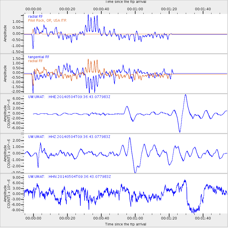
UMAT Pilot Rock, OR, USA - Earthquake Result Viewer
*The percent match for this event was below the threshold and hence no stack was calculated.
| Earthquake location: |
South Of Fiji Islands |
| Earthquake latitude/longitude: |
-25.8/178.2 |
| Earthquake time(UTC): |
2014/05/04 (124) 09:25:14 GMT |
| Earthquake Depth: |
611 km |
| Earthquake Magnitude: |
6.1 MB |
| Earthquake Catalog/Contributor: |
NEIC PDE/NEIC COMCAT |
|
| Network: |
UW Pacific Northwest Regional Seismic Network |
| Station: |
UMAT Pilot Rock, OR, USA |
| Lat/Lon: |
45.29 N/118.96 W |
| Elevation: |
1318 m |
|
| Distance: |
90.9 deg |
| Az: |
38.91 deg |
| Baz: |
233.334 deg |
| Ray Param: |
$rayparam |
*The percent match for this event was below the threshold and hence was not used in the summary stack. |
|
| Radial Match: |
65.7448 % |
| Radial Bump: |
400 |
| Transverse Match: |
70.813385 % |
| Transverse Bump: |
400 |
| SOD ConfigId: |
626651 |
| Insert Time: |
2014-05-18 10:40:57.640 +0000 |
| GWidth: |
2.5 |
| Max Bumps: |
400 |
| Tol: |
0.001 |
|
Signal To Noise
| Channel | StoN | STA | LTA |
| UW:UMAT: :HHZ:20140504T09:36:43.077983Z | 4.1651883 | 8.460076E-7 | 2.031139E-7 |
| UW:UMAT: :HHN:20140504T09:36:43.077983Z | 1.5024527 | 3.5173948E-6 | 2.3411017E-6 |
| UW:UMAT: :HHE:20140504T09:36:43.077983Z | 1.2295084 | 2.6797474E-7 | 2.1795276E-7 |
| Arrivals |
| Ps | |
| PpPs | |
| PsPs/PpSs | |


