You are here: Home > Network List > TA - USArray Transportable Network (new EarthScope stations) Stations List
> Station N50A Nevada, OH, USA > Earthquake Result Viewer
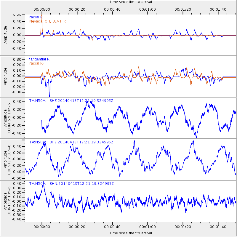
N50A Nevada, OH, USA - Earthquake Result Viewer
*The percent match for this event was below the threshold and hence no stack was calculated.
| Earthquake location: |
Near Coast Of Northern Chile |
| Earthquake latitude/longitude: |
-20.6/-70.7 |
| Earthquake time(UTC): |
2014/04/13 (103) 12:11:30 GMT |
| Earthquake Depth: |
13 km |
| Earthquake Magnitude: |
5.5 MWW, 5.3 MWR |
| Earthquake Catalog/Contributor: |
NEIC PDE/NEIC COMCAT |
|
| Network: |
TA USArray Transportable Network (new EarthScope stations) |
| Station: |
N50A Nevada, OH, USA |
| Lat/Lon: |
40.77 N/83.15 W |
| Elevation: |
277 m |
|
| Distance: |
62.1 deg |
| Az: |
349.365 deg |
| Baz: |
166.838 deg |
| Ray Param: |
$rayparam |
*The percent match for this event was below the threshold and hence was not used in the summary stack. |
|
| Radial Match: |
63.028385 % |
| Radial Bump: |
400 |
| Transverse Match: |
89.42275 % |
| Transverse Bump: |
400 |
| SOD ConfigId: |
626651 |
| Insert Time: |
2014-05-18 11:01:57.230 +0000 |
| GWidth: |
2.5 |
| Max Bumps: |
400 |
| Tol: |
0.001 |
|
Signal To Noise
| Channel | StoN | STA | LTA |
| TA:N50A: :BHZ:20140413T12:21:19.324995Z | 1.5154787 | 3.99452E-7 | 2.635814E-7 |
| TA:N50A: :BHN:20140413T12:21:19.324995Z | 2.9778893 | 2.612855E-7 | 8.7741846E-8 |
| TA:N50A: :BHE:20140413T12:21:19.324995Z | 0.9850109 | 1.897306E-7 | 1.9261776E-7 |
| Arrivals |
| Ps | |
| PpPs | |
| PsPs/PpSs | |


