You are here: Home > Network List > TA - USArray Transportable Network (new EarthScope stations) Stations List
> Station T56A Rocky Mt, VA, USA > Earthquake Result Viewer
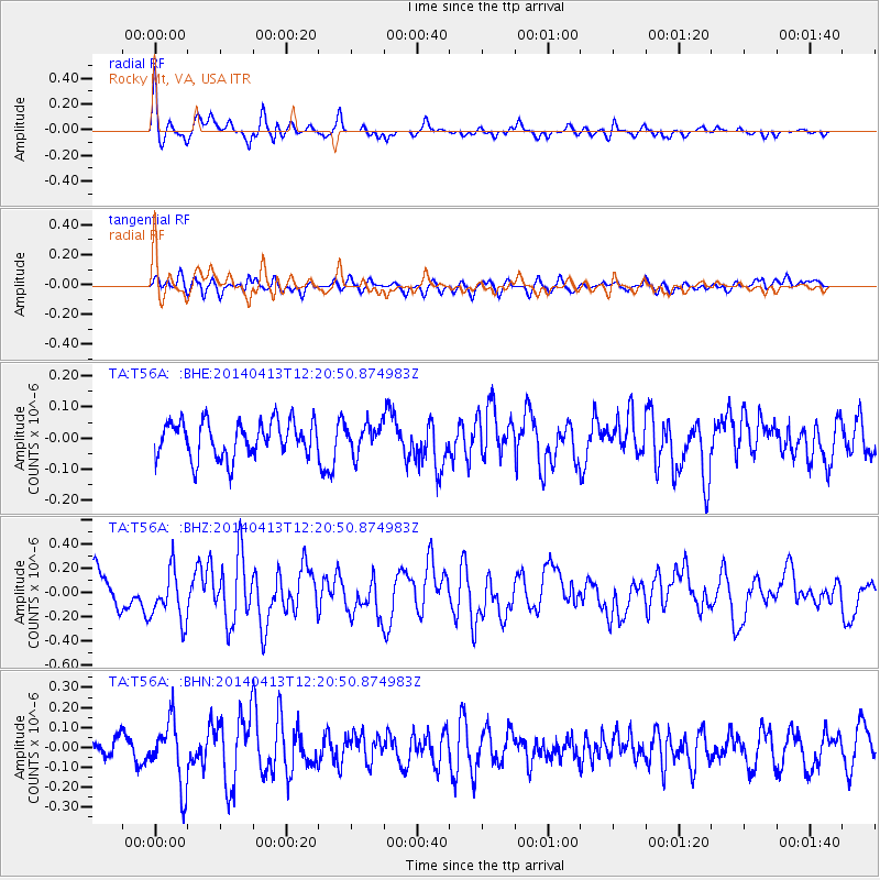
T56A Rocky Mt, VA, USA - Earthquake Result Viewer
*The percent match for this event was below the threshold and hence no stack was calculated.
| Earthquake location: |
Near Coast Of Northern Chile |
| Earthquake latitude/longitude: |
-20.6/-70.7 |
| Earthquake time(UTC): |
2014/04/13 (103) 12:11:30 GMT |
| Earthquake Depth: |
13 km |
| Earthquake Magnitude: |
5.5 MWW, 5.3 MWR |
| Earthquake Catalog/Contributor: |
NEIC PDE/NEIC COMCAT |
|
| Network: |
TA USArray Transportable Network (new EarthScope stations) |
| Station: |
T56A Rocky Mt, VA, USA |
| Lat/Lon: |
37.03 N/80.03 W |
| Elevation: |
387 m |
|
| Distance: |
58.0 deg |
| Az: |
351.238 deg |
| Baz: |
169.726 deg |
| Ray Param: |
$rayparam |
*The percent match for this event was below the threshold and hence was not used in the summary stack. |
|
| Radial Match: |
65.55593 % |
| Radial Bump: |
400 |
| Transverse Match: |
54.98042 % |
| Transverse Bump: |
400 |
| SOD ConfigId: |
626651 |
| Insert Time: |
2014-05-18 11:03:49.920 +0000 |
| GWidth: |
2.5 |
| Max Bumps: |
400 |
| Tol: |
0.001 |
|
Signal To Noise
| Channel | StoN | STA | LTA |
| TA:T56A: :BHZ:20140413T12:20:50.874983Z | 1.5735089 | 2.1215178E-7 | 1.3482719E-7 |
| TA:T56A: :BHN:20140413T12:20:50.874983Z | 2.717162 | 1.600739E-7 | 5.8912164E-8 |
| TA:T56A: :BHE:20140413T12:20:50.874983Z | 0.79529196 | 4.5506955E-8 | 5.7220436E-8 |
| Arrivals |
| Ps | |
| PpPs | |
| PsPs/PpSs | |


