You are here: Home > Network List > TA - USArray Transportable Network (new EarthScope stations) Stations List
> Station G05D Wamic, OR, USA > Earthquake Result Viewer
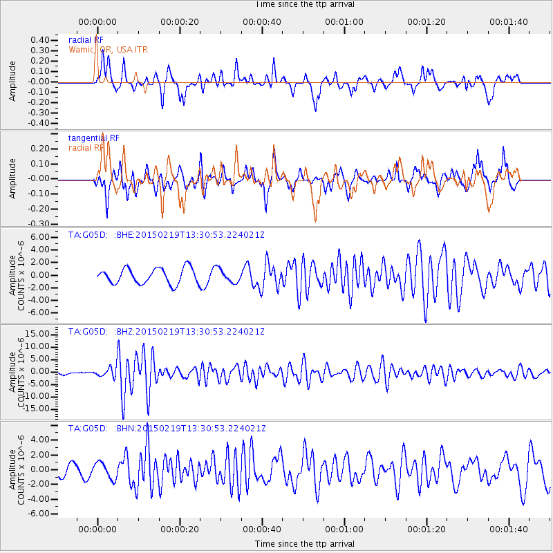
G05D Wamic, OR, USA - Earthquake Result Viewer
*The percent match for this event was below the threshold and hence no stack was calculated.
| Earthquake location: |
Vanuatu Islands |
| Earthquake latitude/longitude: |
-16.4/168.1 |
| Earthquake time(UTC): |
2015/02/19 (050) 13:18:32 GMT |
| Earthquake Depth: |
10 km |
| Earthquake Magnitude: |
6.5 MWP |
| Earthquake Catalog/Contributor: |
NEIC PDE/NEIC COMCAT |
|
| Network: |
TA USArray Transportable Network (new EarthScope stations) |
| Station: |
G05D Wamic, OR, USA |
| Lat/Lon: |
45.24 N/121.32 W |
| Elevation: |
592 m |
|
| Distance: |
88.5 deg |
| Az: |
41.805 deg |
| Baz: |
244.907 deg |
| Ray Param: |
$rayparam |
*The percent match for this event was below the threshold and hence was not used in the summary stack. |
|
| Radial Match: |
75.96761 % |
| Radial Bump: |
400 |
| Transverse Match: |
73.23134 % |
| Transverse Bump: |
400 |
| SOD ConfigId: |
7019011 |
| Insert Time: |
2019-04-16 22:52:06.500 +0000 |
| GWidth: |
2.5 |
| Max Bumps: |
400 |
| Tol: |
0.001 |
|
Signal To Noise
| Channel | StoN | STA | LTA |
| TA:G05D: :BHZ:20150219T13:30:53.224021Z | 6.0994797 | 2.3204052E-6 | 3.8042677E-7 |
| TA:G05D: :BHN:20150219T13:30:53.224021Z | 1.6251383 | 1.1206067E-6 | 6.895454E-7 |
| TA:G05D: :BHE:20150219T13:30:53.224021Z | 0.78273237 | 9.661485E-7 | 1.234328E-6 |
| Arrivals |
| Ps | |
| PpPs | |
| PsPs/PpSs | |


