You are here: Home > Network List > TA - USArray Transportable Network (new EarthScope stations) Stations List
> Station J01E Myrtle Point, OR, USA > Earthquake Result Viewer
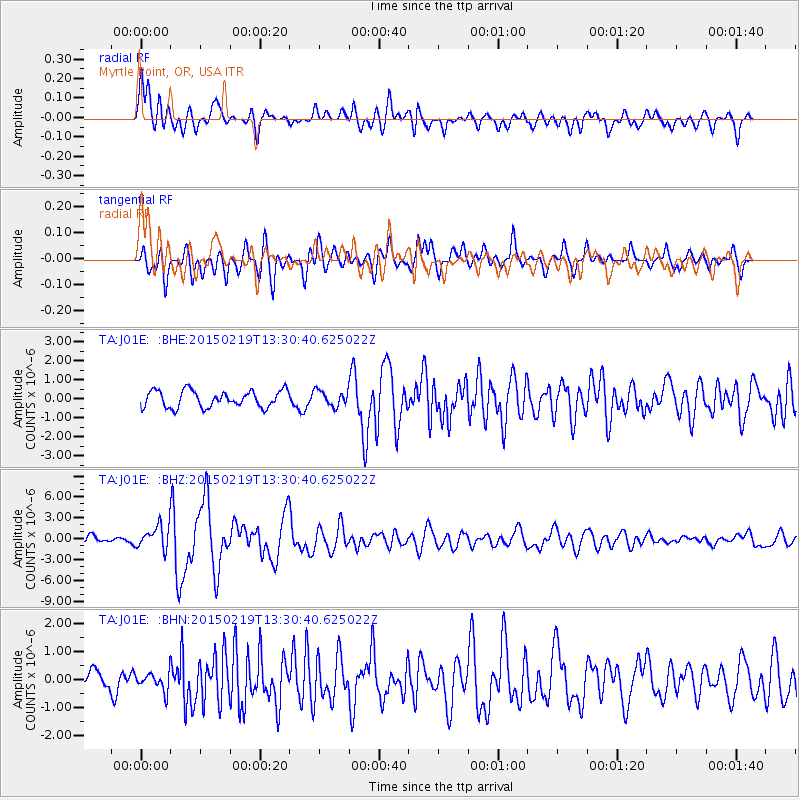
J01E Myrtle Point, OR, USA - Earthquake Result Viewer
*The percent match for this event was below the threshold and hence no stack was calculated.
| Earthquake location: |
Vanuatu Islands |
| Earthquake latitude/longitude: |
-16.4/168.1 |
| Earthquake time(UTC): |
2015/02/19 (050) 13:18:32 GMT |
| Earthquake Depth: |
10 km |
| Earthquake Magnitude: |
6.5 MWP |
| Earthquake Catalog/Contributor: |
NEIC PDE/NEIC COMCAT |
|
| Network: |
TA USArray Transportable Network (new EarthScope stations) |
| Station: |
J01E Myrtle Point, OR, USA |
| Lat/Lon: |
43.16 N/123.93 W |
| Elevation: |
128 m |
|
| Distance: |
85.9 deg |
| Az: |
42.852 deg |
| Baz: |
243.142 deg |
| Ray Param: |
$rayparam |
*The percent match for this event was below the threshold and hence was not used in the summary stack. |
|
| Radial Match: |
65.93756 % |
| Radial Bump: |
400 |
| Transverse Match: |
71.852646 % |
| Transverse Bump: |
400 |
| SOD ConfigId: |
7019011 |
| Insert Time: |
2019-04-16 22:52:12.366 +0000 |
| GWidth: |
2.5 |
| Max Bumps: |
400 |
| Tol: |
0.001 |
|
Signal To Noise
| Channel | StoN | STA | LTA |
| TA:J01E: :BHZ:20150219T13:30:40.625022Z | 3.0121777 | 1.6812011E-6 | 5.5813473E-7 |
| TA:J01E: :BHN:20150219T13:30:40.625022Z | 0.86250585 | 3.2081937E-7 | 3.7196196E-7 |
| TA:J01E: :BHE:20150219T13:30:40.625022Z | 1.0139959 | 4.4017688E-7 | 4.3410122E-7 |
| Arrivals |
| Ps | |
| PpPs | |
| PsPs/PpSs | |


