You are here: Home > Network List > IU - Global Seismograph Network (GSN - IRIS/USGS) Stations List
> Station FURI Mt. Furi, Ethiopia > Earthquake Result Viewer
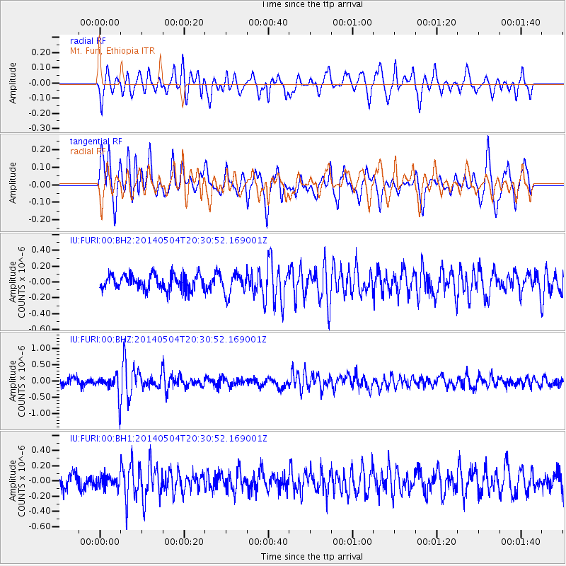
FURI Mt. Furi, Ethiopia - Earthquake Result Viewer
*The percent match for this event was below the threshold and hence no stack was calculated.
| Earthquake location: |
Near S. Coast Of Honshu, Japan |
| Earthquake latitude/longitude: |
34.9/139.3 |
| Earthquake time(UTC): |
2014/05/04 (124) 20:18:25 GMT |
| Earthquake Depth: |
156 km |
| Earthquake Magnitude: |
5.8 MB |
| Earthquake Catalog/Contributor: |
NEIC PDE/NEIC COMCAT |
|
| Network: |
IU Global Seismograph Network (GSN - IRIS/USGS) |
| Station: |
FURI Mt. Furi, Ethiopia |
| Lat/Lon: |
8.90 N/38.68 E |
| Elevation: |
2570 m |
|
| Distance: |
93.6 deg |
| Az: |
283.332 deg |
| Baz: |
54.042 deg |
| Ray Param: |
$rayparam |
*The percent match for this event was below the threshold and hence was not used in the summary stack. |
|
| Radial Match: |
65.78409 % |
| Radial Bump: |
390 |
| Transverse Match: |
79.13789 % |
| Transverse Bump: |
377 |
| SOD ConfigId: |
626651 |
| Insert Time: |
2014-05-18 20:57:14.554 +0000 |
| GWidth: |
2.5 |
| Max Bumps: |
400 |
| Tol: |
0.001 |
|
Signal To Noise
| Channel | StoN | STA | LTA |
| IU:FURI:00:BHZ:20140504T20:30:52.169001Z | 3.0104809 | 3.7148348E-7 | 1.2339673E-7 |
| IU:FURI:00:BH1:20140504T20:30:52.169001Z | 0.7368219 | 7.590106E-8 | 1.03011416E-7 |
| IU:FURI:00:BH2:20140504T20:30:52.169001Z | 1.408373 | 1.3371861E-7 | 9.4945456E-8 |
| Arrivals |
| Ps | |
| PpPs | |
| PsPs/PpSs | |


