You are here: Home > Network List > II - Global Seismograph Network (GSN - IRIS/IDA) Stations List
> Station PFO Pinon Flat, California, USA > Earthquake Result Viewer
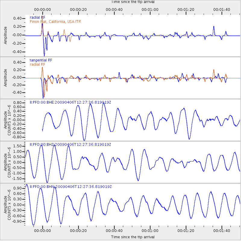
PFO Pinon Flat, California, USA - Earthquake Result Viewer
*The percent match for this event was below the threshold and hence no stack was calculated.
| Earthquake location: |
Tonga Islands Region |
| Earthquake latitude/longitude: |
-22.4/-174.9 |
| Earthquake time(UTC): |
2009/04/06 (096) 12:16:08 GMT |
| Earthquake Depth: |
35 km |
| Earthquake Magnitude: |
5.5 MS, 5.4 MB |
| Earthquake Catalog/Contributor: |
WHDF/NEIC |
|
| Network: |
II Global Seismograph Network (GSN - IRIS/IDA) |
| Station: |
PFO Pinon Flat, California, USA |
| Lat/Lon: |
33.61 N/116.46 W |
| Elevation: |
1280 m |
|
| Distance: |
78.7 deg |
| Az: |
46.499 deg |
| Baz: |
233.56 deg |
| Ray Param: |
$rayparam |
*The percent match for this event was below the threshold and hence was not used in the summary stack. |
|
| Radial Match: |
77.097725 % |
| Radial Bump: |
400 |
| Transverse Match: |
82.12874 % |
| Transverse Bump: |
307 |
| SOD ConfigId: |
2658 |
| Insert Time: |
2010-03-01 21:47:45.442 +0000 |
| GWidth: |
2.5 |
| Max Bumps: |
400 |
| Tol: |
0.001 |
|
Signal To Noise
| Channel | StoN | STA | LTA |
| II:PFO:00:BHZ:20090406T12:27:36.819019Z | 2.4368975 | 1.2308225E-6 | 5.050776E-7 |
| II:PFO:00:BHN:20090406T12:27:36.819019Z | 1.0108261 | 6.315628E-7 | 6.2479864E-7 |
| II:PFO:00:BHE:20090406T12:27:36.819019Z | 1.3519757 | 5.786955E-7 | 4.280369E-7 |
| Arrivals |
| Ps | |
| PpPs | |
| PsPs/PpSs | |


