You are here: Home > Network List > TA - USArray Transportable Network (new EarthScope stations) Stations List
> Station H46A Fife Lake, MI, USA > Earthquake Result Viewer
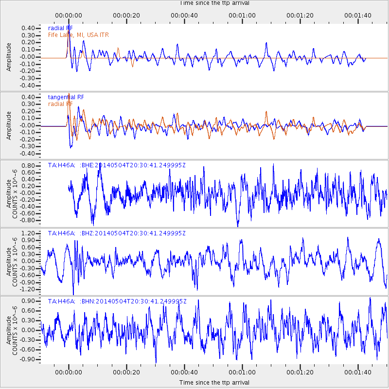
H46A Fife Lake, MI, USA - Earthquake Result Viewer
*The percent match for this event was below the threshold and hence no stack was calculated.
| Earthquake location: |
Near S. Coast Of Honshu, Japan |
| Earthquake latitude/longitude: |
34.9/139.3 |
| Earthquake time(UTC): |
2014/05/04 (124) 20:18:25 GMT |
| Earthquake Depth: |
156 km |
| Earthquake Magnitude: |
5.8 MB |
| Earthquake Catalog/Contributor: |
NEIC PDE/NEIC COMCAT |
|
| Network: |
TA USArray Transportable Network (new EarthScope stations) |
| Station: |
H46A Fife Lake, MI, USA |
| Lat/Lon: |
44.54 N/85.20 W |
| Elevation: |
329 m |
|
| Distance: |
91.2 deg |
| Az: |
30.101 deg |
| Baz: |
324.797 deg |
| Ray Param: |
$rayparam |
*The percent match for this event was below the threshold and hence was not used in the summary stack. |
|
| Radial Match: |
61.868694 % |
| Radial Bump: |
400 |
| Transverse Match: |
66.54567 % |
| Transverse Bump: |
400 |
| SOD ConfigId: |
626651 |
| Insert Time: |
2014-05-18 21:10:19.861 +0000 |
| GWidth: |
2.5 |
| Max Bumps: |
400 |
| Tol: |
0.001 |
|
Signal To Noise
| Channel | StoN | STA | LTA |
| TA:H46A: :BHZ:20140504T20:30:41.249995Z | 1.9462198 | 5.878446E-7 | 3.0204433E-7 |
| TA:H46A: :BHN:20140504T20:30:41.249995Z | 1.1910163 | 2.985294E-7 | 2.5065097E-7 |
| TA:H46A: :BHE:20140504T20:30:41.249995Z | 0.6126453 | 2.0421771E-7 | 3.3333757E-7 |
| Arrivals |
| Ps | |
| PpPs | |
| PsPs/PpSs | |


